Posts Tagged ‘Photography’
Côte d’Azur & Les Alpes-Maritimes
Team orson embarks on a quickie, one-week venture across the border to the motorcycling playground that is the south of France.
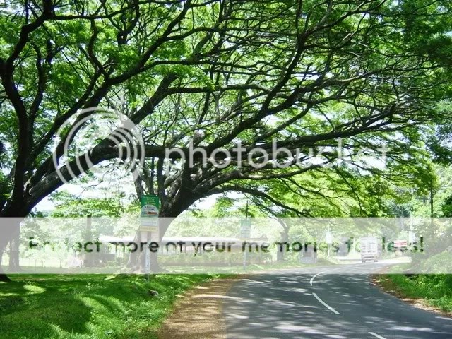
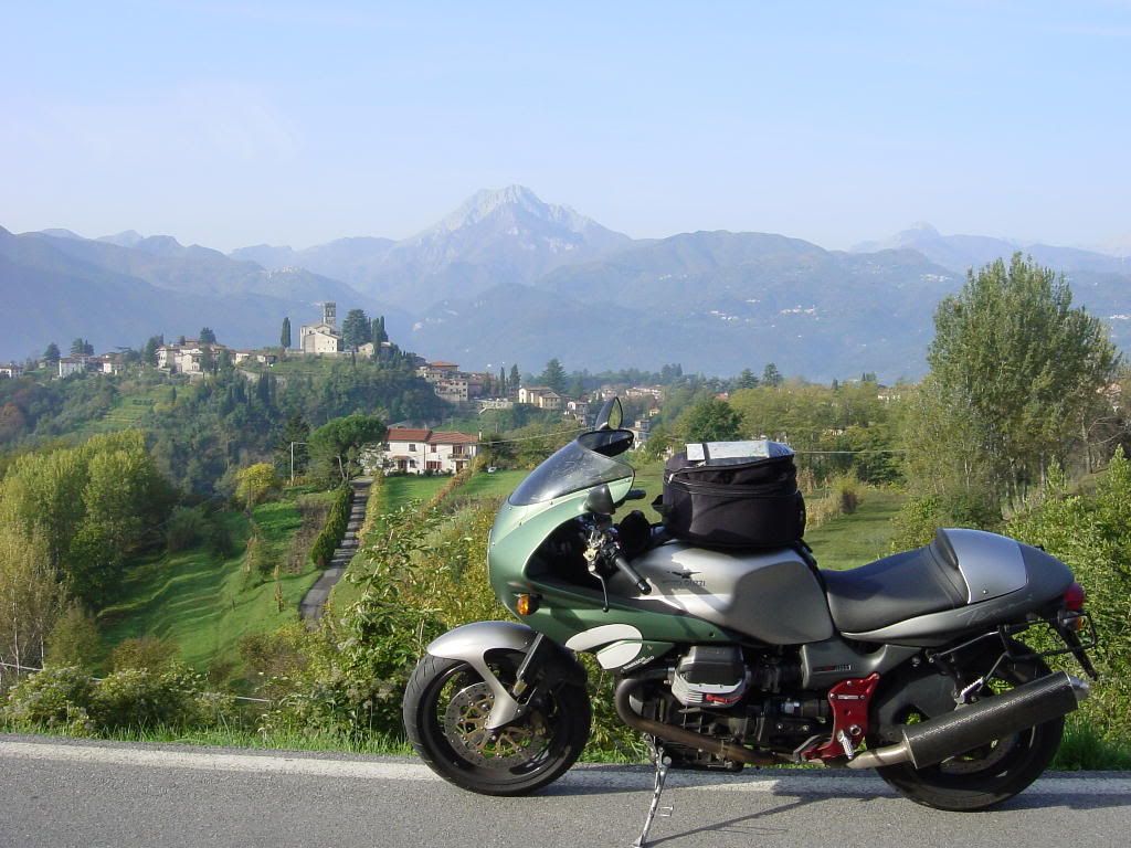
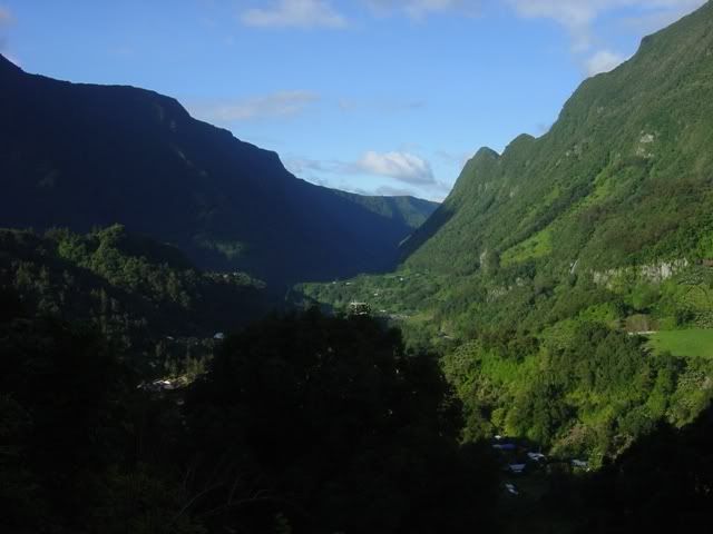
Departing from team orson’s world headquarters in Parma, we stick to the backroads as we make our way across the Apennine mountains to the coast. The early fall temperatures combined with the altitude serve to feed the mighty, mighty goose with a horsepower boost in the form of cool, mountain air. We reach the coast by late afternoon and get a hotel room near Portofino. I didn’t take any pictures, so I’ll cheat and use a picture from a previous trip.

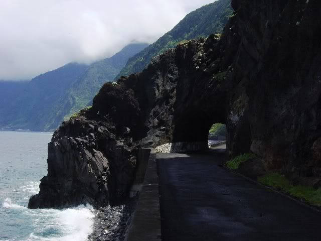
In a bid to save time, the next day’s route will be a blast up the Ligurian coast along the autostrada, the same stretch used by Richard Hammond to race James May in a cigarette boat. The road features dozens and dozens of tunnels cutting thru the mountains that line the coast. I can’t even begin to imagine how long the trip must have taken before the autostrada was constructed.
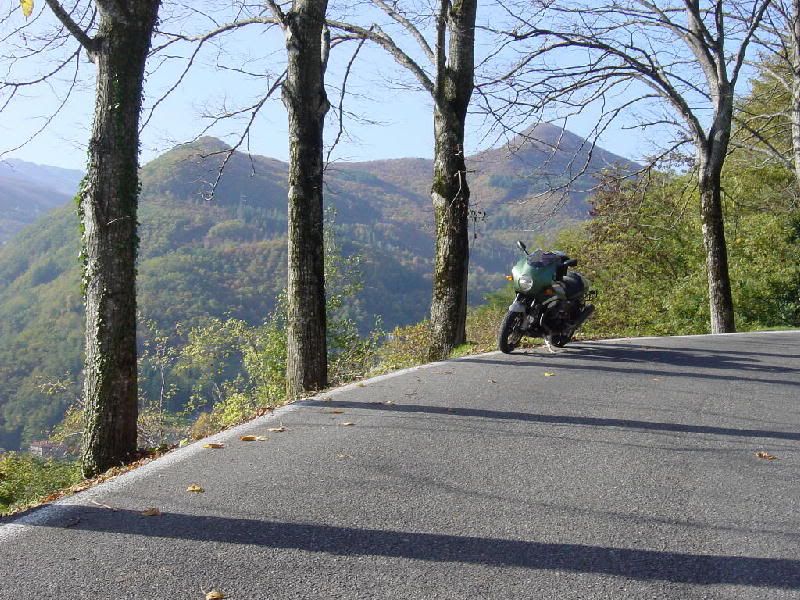
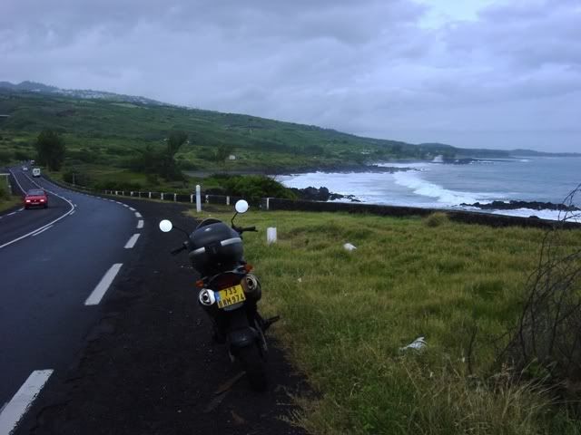
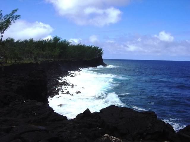
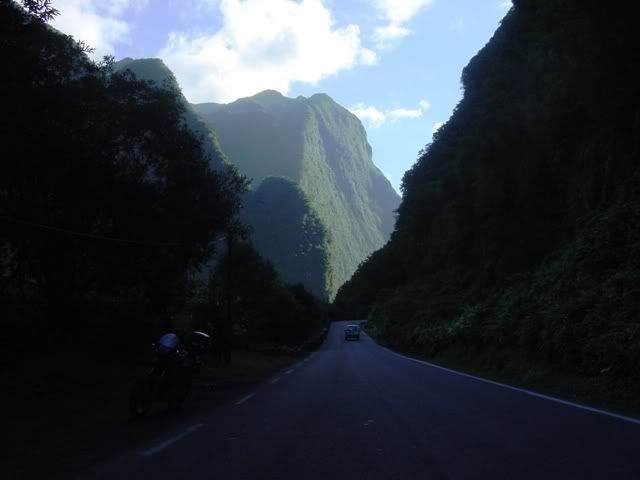
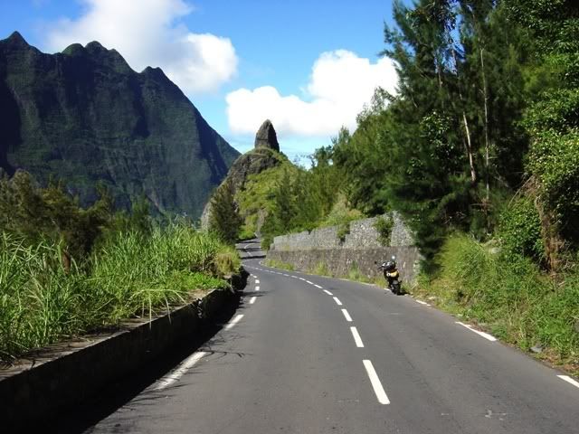
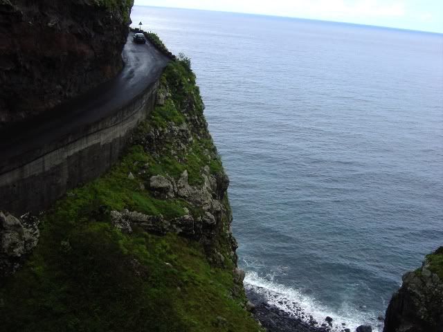
Just after crossing the French border, we leave the highway and head up into the hills in search of twisties. As you approach Monaco, you begin to notice an increase in the amount of auto exotica. In a matter of a few hours, I must have seen four or five Bentleys and a couple of Ferraris. Porsches and Mercedes seemed downright pedestrian in these environs. This is the closest they will allow you to get to Monaco on a Guzzi.

With the purchase of an iPad, this would be the first trip where team orson traveled with any electronic devices besides a digital camera. Perhaps lured by the flashing lights and whirring noises of this strange device, the team orson navigator threw caution to the wind and drunkenly decided to make a hotel reservation with the contraption. His reckless action would very soon come back to haunt team orson.
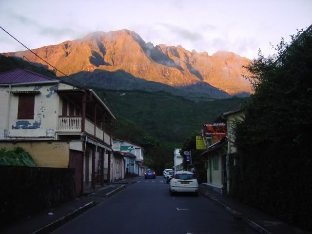
A tip that the ride along the coast to Cap d’Antibes was enjoyable proved to be wrong, as we encountered lots of traffic and very little scenery. With the skies beginning to darken forbiddingly, the decision was made to turn inland at Cannes and hit La Route Napoleon. A few years ago, BIKE magazine declared La Route Napoleon to be the “Best road in Europe.” While that would be a subjective opinion for sure, in my opinion they weren’t far off the mark.

Fast and flowing, La Route Napoleon may be short on photographic charms, but is top shelf stuff for releasing your inner Mike Hailwood 😀 For about sixty blissful kilometers, there are almost no towns or side roads to slow your progress. The mostly open nature of the terrain means that four-wheeled chicanes are easily dispatched.

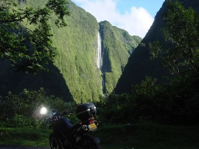
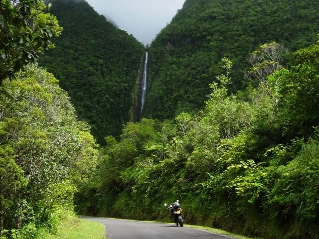
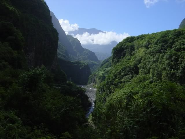
Approaching Castellane, the dark skies begin to release their moisture with a vengeance. In the past, team orson would have retired to the nearest warm and dry hotel room. But now armed with a newfangled i-Pad, team orson felt compelled to continue onto their reserved hotel room, some 100 kilometers distant. Harsh words were exchanged between the team orson photographer and navigator, as the benefits of modern technology were called into question.
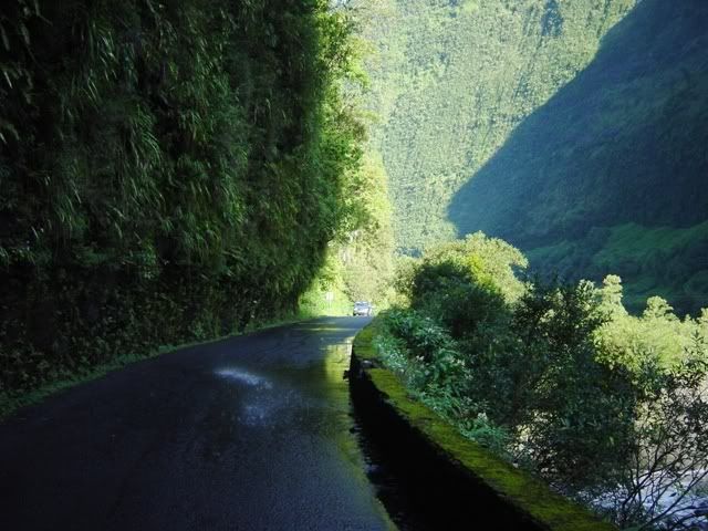
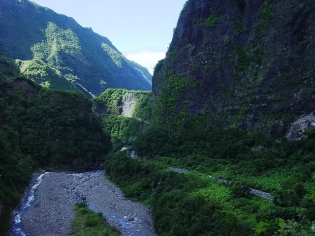
The last fifty kilometers were a slow, wet slog along the road that hugs the northern edge of the Canyon du Verdun. Although it was raining heavily, brief glimpses of its grandeur occasionally revealed themselves. Thankfully, the rain began to taper off later in the afternoon, allowing for a few photographs thru the mist.


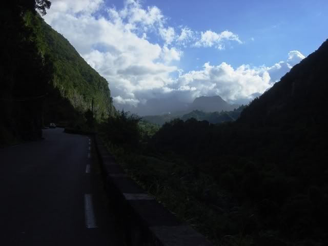
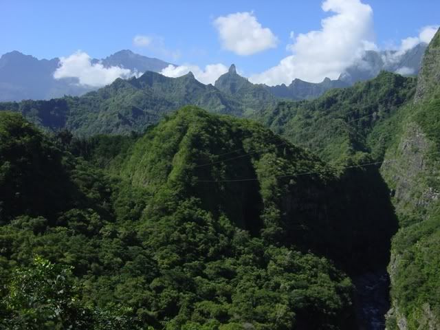
The following morning dawned with an improved weather forecast, and I spent the day meandering back along the northern edge of the canyon before returning along the southern edge.


Coming into a small village, I saw a large group of about 20 motorcycles leaving a gas station. My initial reaction was, “Oh great. I’m going to have to work my way thru the slow pokes.” Not to worry though. This was France and these weren’t a Harley parade. Within a minute, the group had blasted away. France has a fantastic moto-culture. Despite having roughly the same population as the UK, they have twice as many registered motorcycles.


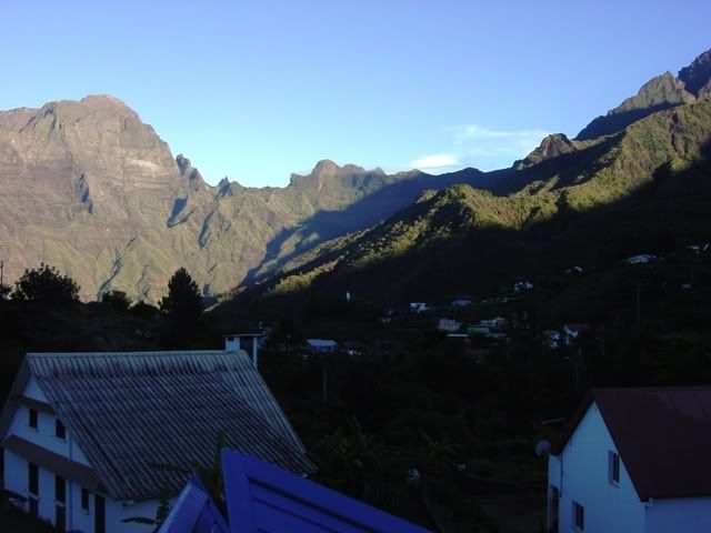
I stayed the night in the picturesque town of Moustieres-Sainte-Marie on the western edge of the canyon. The hotel’s restaurant was fantastic and I left thoroughly bloated after a six-course meal. Even the dessert had a dessert.
Moustieres-Sainte-Marie in the morning light.

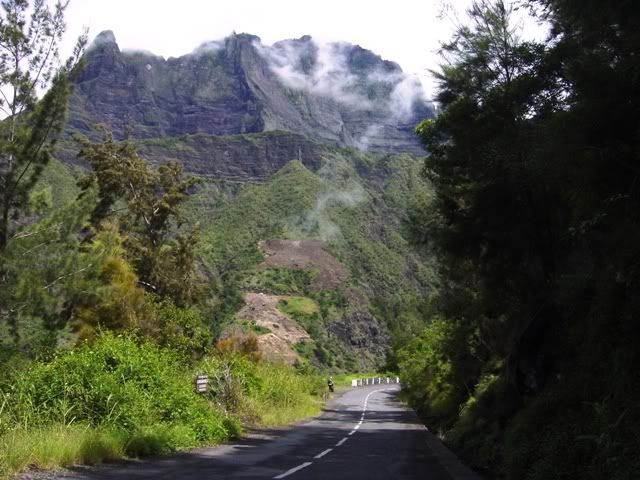
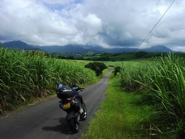
We headed north towards les Alpes Maritimes. The south of France is chock full of lazily, twisting two-lane roads.

I was amazed at how little traffic there was on these roads. I stopped to take this picture, and not a single car came by during the entire five minutes that I was stopped.

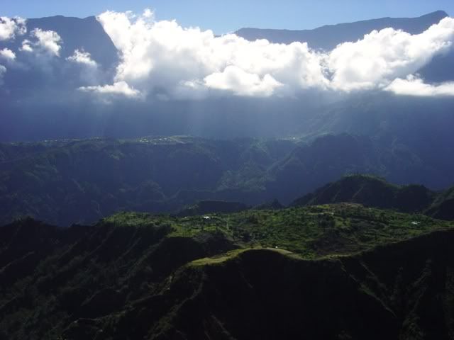
The mountains begin to grow as you approach Barcelonnette.


At Jausiers, I turn south and head up la Col de la Bonette. The road signs claim that it is the highest paved road in Europe, but Wikipedia disputes this, claiming that it is only the third highest road. As I begin the climb, the skies begin to darken once more. As I reach the summit and begin the descent, I catch a glimpse of the rain waiting for me in the valley below.

Fortunately, by the time I make it to the valley floor, the rain has dissipated and I scamper off to find a hotel room. I awaken the next morning to a blazingly blue sky and turn back north. I’m not sure if this is a castle of maybe a monastery high above the valley floor.

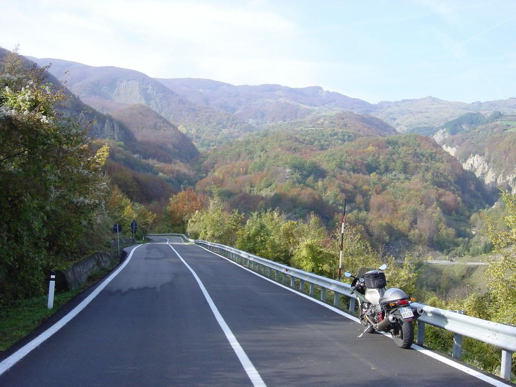
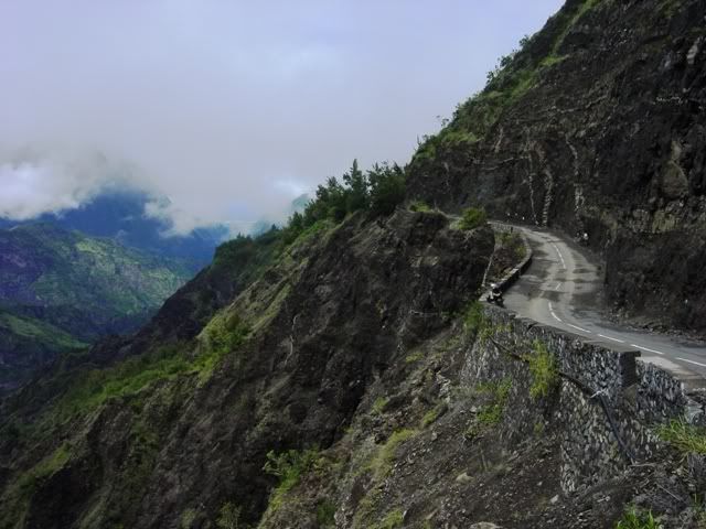
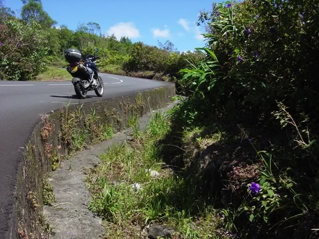
The D-2202 between Annot and Guillaumes…oh my, my :drool: Such a wonderful stretch of tarmac is the stuff of dreams. the pictures can’t begin to do it any justice. I rate the French highway system among the best, if not the best in the world. Most of the main roads a paved with smooth, well marked asphalt.

A close up of the church in the distance.

Looking back at the D-2202 show it snaking its way alongside a riverbed.

After Guillaumes, the road narrows as it begins to climb la Col de la Cayolle. this climb seemed to go on forever.

About 10 kilometers short of Barcelonnette, I came upon this road works. D’oh! Merde Alors! I would have to backtrack almost an hour if I couldn’t get by.

Using my high school French, I found out that they would open the road in one hour, so i decided to cool my heels and wait.
After topping up the gas tank in Barcelonnette, I turned south once more and headed up la Col de Maure. While the fall colors aren’t as spectacular as New England, there were a few spots of vibrant color.

After a long day slaying mountain passes, the mighty, mighty goose stops to absorb some of the scenery.

The D-6202 is another wonderfully enjoyable road on a motorbike, fast and flowing, with hardly any traffic or pesky switchbacks to slow your pace. This trip to Provence has only served to solidify my belief that, the south of France has some of the best motorcycling roads anywhere on the planet. Wales & Scotland come close, but get knocked down a notch because of their infamously, soggy weather. Northern California and the south of France are the top of the pops in my book.
Once again I awaken to bright, blue skies, but alas, my time is running short. I point the goose back towards Italy for the homeward leg. I take a small detour off the autostrada in Italy to the bridge at Dolceacqua that was painted by Claude Monet.

Further up the road is the picturesque town of Apricale, perched precariously on a hilltop.

Once again, I use the autostrade to blast down the Ligurian coast. Looking back north along the coastline.

I spend the last night in Portofino. The view of Portofino harbor from the hotel room balcony.

In an effort to blend in with the local populace, team orson purchased some spiffy, Italian loafers. Whereas team orson was treated as a furriner before, now people mistake us for locals and stop to ask us for directions.

The next morning, we begin our final leg across the Appenines back to Parma. The scenic road leaving Portofino.

I stop for lunch in a small town and take a final photograph of possibly the most beautiful sport touring bike on the planet. Ten years on and the bike never missed a beat, still going strong after 80,000 km.

Route Map:

Trip stats:
Distance- 2,000 kilometers
Travel days- 8
Rest days- 0
Carabinieri sightings- 3
Gendarmerie sightings- 0
Deer sightings- 0
Bee stings- 2
Western Scotland & Northern Ireland
A plan was hatched to do Scotland properly. I had been once before in 2003 when the Guzzi was in a friend’s barn in Shropshire. At that time, I only had a week and had only made it as far as the Isle of Skye before time ran out and I had to turn around and head south. Still, what I had seen was enough to whet my appetite for more.
A P.M. was fired off to a friend in Scotland, asking for a few route tips. Instead, he went far above the call of duty and provided Google maps and plenty of suggestions on where to stay. He even went as far as to arrange an oil change in Aberdeen for my Thruxton. I hafta doff my chapeau to him. I owe him the equivalent in return. Unfortunately, as I headed out the door to the airport, I left his maps and printed advice on the kitchen counter. D’oh!
After an overnight flight to the U.K., I arrived in Nottingham and loaded up the Thruxton. By 2 P.M., I was on the road and heading north along the A1. At Scotch Corner, I turned westward on the wonderful A864 across the Yorkshire Dales. It was at this point that the team orson photographer realized that he had forgotten the camera’s battery back in Nottingham. He tried to blame it on jet lag but, his actions were inexcusable
At around 6 P.M, it began to rain lightly (this would be a recurring theme) and decided on a nice inn near Hawes. The plan for the following day would be to make time on the M6 motorway in order to catch the final day of the 100th running of the legendary Scottish Six Days Trial held around Fort William. I got lost in Glasgow and ended up heading northeast instead of northwest. I finally realized my mistake when I reached Stirling but, it turned out to be a fortuitous mistake as, the A84 turned out to be a great ride. Ha! Let’s see yer GPS do that!
Back when I was but a wee lad, the Scottish Six Days Trial was a major motorcycling event, dutifully reported on by the U.S. bike rags along with the ISDT and the Motocross des Nations. Sadly, in this day of freestyle MX and stunt shows, the trial has lost it’s luster and like the Daytona 200, lives off its former glory. Still, I felt an urge to witness this unique event in which trials riders cover as much as 100 miles per day over 6 days.
From my hotel, I rode up towards Kinlochleven, not really sure what I was looking for. After riding through the town and seeing no signs of the event, I eventually came across many cars parked alongside the road. A short walk up a dirt road soon had me at one of the sections along a rocky creek bed. It was interesting to see how the different riders tackled the sections, from the apprehensive youngsters to the wiley gray beards. Although the skies threatened to rain, it stayed mostly dry.
I then rode a few more miles to reach the famous Pipeline Section. Since I didn’t have a camera. It’s difficult to convey how long and how steep it is. It’s so long, they separate it into four sections. It was amazing to watch the riders switch from unstoppable bulldozer mode to ballerina mode then back to bulldozer several times.
Later in the afternoon, I rode to Fort William for the awards ceremony and to walk around the pits. A couple of blasts from the past were there with the team Ossa truck as well as the newly reformed Greeves factory. I was hoping to score a 100th SSDT t-shirt but, they were sold out and I had to settle for a beanie.
The next day, I woke up to face of an ominous rainy weather forecast. I was to ride across the breadth of Scotland to meet up with my friend in Aberdeen on the east coast. Amazingly, I rode through bright sunshine all the way up until 2 P.M. when a brief shower finally lashed out at me. Upon reaching Aberdeen, directions from a friendly local soon had me my friend’s front door.
My friend lives in an amazing home, formerly a church. If you’ve ever watched a James Bond film where the protagonist is invited into Dr. No or Goldfinger’s lair, that’s what it was like. A vast open area with a couple Ducatis and a KTM motard overlooked by a huge stained glass window. I think having a Bond villain’s lair is everyone’s fantasy. Impressive!

Following his advice, we agreed to make the fishing port of Ullapool our base of operations on the west coast. We left Aberdeen the next morning headed towards, Edinburgh. As I was just following my friend rather than relying on a map, I had no idea where I was but, the sun was out and the traffic was light so, all was well in the world. The highlight of the day had to be the road on the north shore of Loch Ness. What a magnificent motorcycling road with fast, sweeping curves and lots of places to pass slower traffic.
Looking north from the south end of Loch Ness

After a drenching rain, we finally reached Ullapool just after 7 P.M. A fish and chips dinner from the local chippie, a hot shower, a wee dram of scotch and it was off to never never land to sleep the sleep of the dead.
Sunset over Ullapool

The next day we headed north, using the single track road that hugged the coast.
Heading towards Achiltibuie on the Coigach coast


Continuing northwards

Encountering two other bikers heading south

The coastline reminded me of Norway at times


Despite the threatening rain, we remained dry as we approached the north coast.

Near the north coast, the Highland terrain opened up and offered vast vistas


We reached Durness on the north coast at around 4 P.M. before deciding to return to Ullapool via the main highway.
Views heading south


Dropping down into Ullapool from the north

In Ullapool, we managed to find a shop that sold cheap digital cameras so, apologies if the pictures aren’t up to snuff. We returned to our friendly hosts at our bed & breakfast just outside Ullapool for a hot shower and a nice steak dinner. After a good night’s sleep, we headed south from Ullapool, again following the coast.


The Isle of Skye hoves into view off our starboard

Belach na Ba kind of surprised me. Being so close to the coast, I wasn’t prepared for something that resembled an Alpine pass.
My friend heading downhill on his Ducati

Loch Carron. Somehow, dark and moody seems to fit this location better than bright sunshine

By 5 P.M. we were still on the west coast and my friend had been hoping to make it to Aberdeen that night! At Locharron, we bade our farewells and went our separate ways, my friend back to Aberdeen while I headed back to Ullapool for one more night before catching my ferry to the Outer Hebrides.
Outer Hebrides
The following morning I woke up to more rain. I suited up and made the short ride into town to the ferry pier. Only three other bikes waiting to board. You must really want to go to get there.

By the time the ferry reached Stornoway on the Isle of Lewis at midday, the weather had improved. The rugged Isle of Lewis and Harris contain some of the oldest rock formations in Europe. While the scenery might be stark and bleak, I’ve always been attracted to these “edge of the world” type places.
Desolate isolation on the Isle of Lewis

The standing stones of Callanish whose meaning has been lost in the mists of time.

From Callanish, I turn south along the rugged western coast of Lewis


I continued south until grass started growing out of the asphalt. A sure sign I was getting near the end and would have to turn around

I should note that these aren’t ideal sport touring roads or even motorcycling roads at all but, if you have an itch for remote places, the Outer Hebrides definitely scratches that itch.
Pointing north

I rejoin the main highway and head to the southern part of the island known as Harris which is even more rugged than Lewis

In the town of Tarbert, I find a cozy bed & breakfast run by an elderly woman who reminds me of my mother. I’m struck by the friendliness and warmth of the Hebridean people.
The next morning, I continue south to catch another ferry, this time to the Isle of North Uist. I make a quick detour to the small island of Scalpay where I again reach the end of the road and am forced to turn around.


I’m surprised when the sun makes a rare appearance to reveal some pristine, sandy beaches on South Harris


I reach the ferry port at Leverburgh to find that I am the only motorcyclist waiting in line. You must really, really want to get somewhere to be the only motorcyclist.

The ferry ride to North Uist took about 50 minutes but, it was no simple crossing as the captain had to zig-zag his way amongst a veritable mine field of rocks and islets. He definitely earns his paycheck. Although not quite as rugged as Lewis & Harris, North Uist seems even less populated and remote


A lonely telephone box stands sentinel along a back road

North Uist is connected to the Isles of Benbecula and South Uist by a series of causeways. A local told me that during a bad, winter storm, a car and its occupants were swept off a causeway and out to sea by a rogue wave.
Another squall about to drench me blows in off the Atlantic. The wind was blowing the entire time I was on the Outer Hebrides. I can only imagine what the winter storms must be like

I made it as far south as the Isle of Eriskay off the southern end of South Uist before turning around and heading north. About 10 miles from my hotel, I was hit by yet another drenching squall. Suddenly, the Thruxton sputtered to a stop as if it had run out of fuel. Great! I was stranded in the middle of nowhere, with the rain pouring down. I peered into the gas tank and gave it a shake. I pushed the starter button again and, she fired right up! Hmmm. Maybe the carbs sucked in some rain or sumthin. I high tailed it to the hotel before she changed her mind again. That would be the only hiccup during the trip.
The next morning on the main road on North Uist (seriously, this is the main road), a herd of sheep blocks rush hour traffic. By the time they had been herded to their paddock, a four-car traffic jam had been created

I made my way to Lochmaddy where the MV Hebrides would take me on the 2 hour crossing to the Isle of Skye.

Once again, I was the only motorcycle on the boat. I didn’t see any motorcycles that looked like they were ridden by locals on the Hebrides. The few bikes I saw were obviously touring. With their roads and their weather, you’d have to be serious to be a regular motorcyclist on the Hebrides.
Once on Skye, the weather let lose with a vengeance. The forecast called for two solid days of rain so, I did what every perfeshunal dilettante does and found a nice hotel to hole up in and get some laundry done.

Eventually, the rain let up a bit but, not enuff to give me blue skies. Portree is the main town on Skye

The Cuillin Hills in the distance on the Isle of Skye

Ferry number 4 would take me from Skye back on to the mainland

Argyll
The Morvern Peninsula is an isolated place of wonderfully stark scenery

In the little town of Lochaline, I stumble upon the White House restaurant that serves locally sourced meals. It was here that I had one of the best meals of the trip. These unexpected gems that you happen upon by chance are part of the allure of travel for me.
Heading back north along Loch Linnhe with ever-present threatening skies

Ferry Number 5 takes me across Loch Linnhe

Once again heading south, I make a detour thru Glen Coe. This is one of those places, like Yosemite, whose beauty stands out even in inclement weather


I continue south through the port city of Oban which kind of reminds me of small version of San Francisco. A western port with a slightly seedy underbelly. I make it as far south as Lochgilphead before a bit of rain followed by a strong, cold wind makes me stop for the night.
The next morning I head south along the west coast of the Kintyre Peninsula on the A83. With a good view of the ocean and a salty sea air, it stirs memories of my days in Northern California


At Campbeltown, I fill up with fuel and turn north following the single track lane up the eastern side of the peninsula

At Claonaig, I await ferry number 6 to take me across as the Isle of Arran looms in the distance


Impressive mountains of Arran

I head east across the middle of the island and get a view of the Firth of Clyde with the Scottish mainland in the distance

A one hour ferry ride takes me back to the mainland at Androssan where I make a quick hop south to get a hotel in Troon in preparation for tomorrow’s ferry to Northern Ireland.
I wake up bright and early on Friday and make my way to the ferry terminal. This is the day before the North West 200 race in Northern Ireland and this time, I surely won’t be the only motorcyclist on the boat. I’m one of the first bikes in line and get to watch the bikes accumulate

I soon begin to notice a trend. Most of the race fans are in their 50s or close to their 50s. I see a few riders who might be in their mid-30s and none in their twenties. I’m wondering if high insurance rates are the cause of the lack of youth or maybe it coincides with the birth of the internet some twenty years ago.
Soon the signal is given and the horde of bikes is herded on board. I figure there must be between 200 and 300 motorcycles

Northern Ireland
I arrive in the port of Larne at about midday and am met by fellow Guzzisti, BelfastGuzzi from the V11lemans web site and his friend, both on Guzzis, who have kindly offered to provide me a tour of the northern coast

The North Antrim coast road doesn’t seem to get much press but, it’s a fantastic ride. Much too tight and lined with stone walls for any kind of serious sport riding but, the scenery more than makes up for that

BelfastGuzzi takes me on a road less traveled that hugs the coast and offers spectacular views of Torr Head

The picture doesn’t adequately convey the steepness of the single track lane descending the hillside


Unfortunately, race day dawns with a windy rain. I walk from my hotel down to the grassy viewing area at the Metropole and by the time I find a place to sit, the rain is diminishing

By the 11:00 starting time of the North West 200 race, the rain has stopped although the track remains wet. The 600 Supersport class leads off and Aussie Cameron Donald engages local lad Alastair Seeley in a ding-dong back and forth battle. Donald’s Honda seems to have the ponies but, Seeley’s Suzuki gets him under braking and manages to hold on for the win.
Unfortunately, during the Superbike race, a bike spews its oil on the racing line as it begins to rain again. Cleaning up the track and a bomb threat to the paddock throw a wrench into the works and, by 4 P.M. the organizers decide to call the event in the name of safety. I can’t say I blame them. following a mist of spray at 190 mph is no place to be.
Still, I’m glad I went as I got a good feel for the event and enjoyed the atmosphere. Excuse the crappy hand held photos
Entering the Metropole Section after a 160 mph straightaway

The famous railroad bridge

which leads up a slight rise into a blind right hand kink

I walked further down the coast to get a shot at the top of Black Hill

As luck would have it, the day before and the day after the race were rather nice. I mount up and head west towards Donegal in Ireland

You can hardly tell when you cross the border between Ireland and Northern Ireland. If there were any signs, I missed them. I make my way to Glenveagh National Park against a considerable head wind. I’m surprised by the sparse vegetation, almost looking a bit like New Mexico. Not what I expected of Ireland.

After about 4 hours, I reach the west coast of Ireland

I turn back towards the east and what was once a headwind, now became a tail wind…woo hoo!
A sectarian mural in Northern Ireland. Bobby Sands and Che

I continue eastward on the scenic Barnes Gap scenic route thru bucolic countryside

I had planned to go see the Joey Dunlop memorial in Ballymoney the following day but the weather once again foiled my plans. High winds with gusts up to 70 mph created havoc across Northern Ireland toppling trees and making it generally unsafe to try and ride a motorcycle. The high winds also forced the cancelation of my 5 P.M. ferry so, I had to book for the following day.
The next morning, the winds had subsided and I made my way back to the ferry port in Larne.
I don’t know which is more impressive…this guy riding an Aprilia 125cc two-stroke from Scotland

or this guy who rode a BSA Lightning from Switzerland

I arrive back on the Scottish mainland at Cairnyan and begin to make my way towards England across the Scottish Borders district

After spending the night in Carlisle, I begin my last day on the road with my last bit of two-lane across the scenic Northern Pennines


At Scotch Corner, I grab lunch then hit the M1 Motorway and make the final blast down to Nottingham. Despite all that rain in the forecast, I really only had about four bouts of riding in solid rain. The rest of the times I was dodging rain showers or riding in a drizzle which wasn’t hardly like rain at all and, even had a few spells of sunshine. I had previously rated the Kiwis as the friendliest people I had encountered but, after this trip, I think the Scots and the Irish are on par with the Kiwis. Outstanding hospitality.
Trip stats:
Mileage: 3000 miles
Travel days: 18
Rest days: 3 (due to rain & winds)
Ferry crossings: 9
Police encounters: 2
Police interaction: 0
Midge attacks: 1
Route Maps:


South Wales
During my recent visit to the U.K., they were experiencing unseasonably warm weather for this time of year. In the U.S., they would call it an Indian Summer. I dunno what they would call it in Wales. A Druid Summer?
I arrived in Nottingham and reunited with my Triumph Thruxton after a two year absence. The Trumpet fired right up as if it were only yesterday. We set off towards Wales under cement gray skies but, with an improving forecast. When I say cement gray skies, I don’t mean cement-colored but that, it actually looks like the sky is filled with cement. A thick pea soup mixture that dulls everything it touches. The grayness persisted for the entire first day of the trip so, not many pictures.

After overnighting in Brecon, Wales, day two dawned under similarly gray skies but, the weatherman was calling for patches of sun as I headed south across the Black Mountains. As I crossed over the top of the mountains, the fog was so thick that, I had to slow down considerably and had to allow a car towing a caravan (camper) to pass 😮
By 10:30 A.M., I was beginning to detect some brightness through the mist

Fall colours

Welsh backroads tend to be a tad narrow, down to one lane wide in places with pullouts to allow other traffic to get by

By noon, the sun was out in full force as I approached Swansea on the south coast

After getting through Swansea (a lovely looking city), I made my way to the Gower Peninsula. I stopped at the seaside village of Port Eynon for a lunch of fish & chips. I talked to a couple of local riders, one on a Harley and the other on a beautifully maintained, 30 year old Kawasaki Z900. I continued on to the town of Rhossili where, I found lodgings at a hotel overlooking Worm’s Head

Looking north from Worm’s Head to the wide expanse of beach. The little black specks in the water are surfers. Yes, surfers in Wales…in October

Sunset over Worm’s Head

The next morning, I was so taken by the beauty of the locale that I had to snap a few more pictures

Exploring the narrow roads along the coast. In the U.S. this would either be a bicycle or golf cart path. It’s hard to make out due to the brightness of the sun but, that’s the Bristol Channel on the horizon

On my third day, I left the Gower Peninsula and made my way around the Loughor Estuary, following the coast towards the Pembrokeshire National Seashore. The rugged Pembokeshire coast near the town of Bosherston

Continuing westward, there were many other people out enjoying the fine autumn weather

Looking back eastward along the narrow, coastal road

I spent the third night in Haverfordwest before continuing the next day towards St. Brides Head in far Western Wales

The village of St. Brides is as peaceful and idylic as they come. Location, location, location

Nearby, two fishermen were setting their pots

I continued north along the coast, trying to stay as close to the shore as possible by following the narrow, one-lane roads. Less sport and more touring really. Looking back south along the coast

Approaching the town of Broad Haven

Coastal farms were in abundance

A solitary stroller enjoying the fine day along one of the broad, Welsh beaches near the town of Newgale

Time was beginning to run out and I had to begin to make my way northeast towards Nottingham. The mysterious Preseli Hills from which the bluestones of Stonehenge eminate, hove into view

I rejoin the coast at Cardigan and follow the coastal road northwards past retirement and vacation homes. Near Aberystwyth, I find a nice country hotel with a splendid view and a fine restaurant. I enjoy a nice meal with accompanying adult beverages for my last night on the road. Wales is the closest place I’ve found that matches the beauty of Northern California. Sonoma County or Wales?

The next morning dawns bright and shiney and after a full Welsh Breakfast, I point the bike eastwards back towards England but, not before getting a few final pictures of the stunning Welsh countryside


The roads open up as the terrain begins to change. The Triumph falls into a relaxed pace as if trying to delay the journey’s end. It seems happiest when just puttering along at 65 to 70 mph on a lazily sweeping two-laned roads. A steady, unhurried beat like a Miles Davis composition 🙂

All in all, I couldn’t have asked for better weather. To expect 4 days of continuous sunshine in October is to be tempting fate but, somehow it was as if I flew through the eye of a needle. I get the feeling I may have to pay on a later journey.
Route map:

Trip stats:
Riding Days: 5
Rest Days: 0
Mileage: 800
Police encounters: 0
Deer encounters: 0
Sheep encounters: 1,000,019
Bee stings: 0
2010 Central Italy
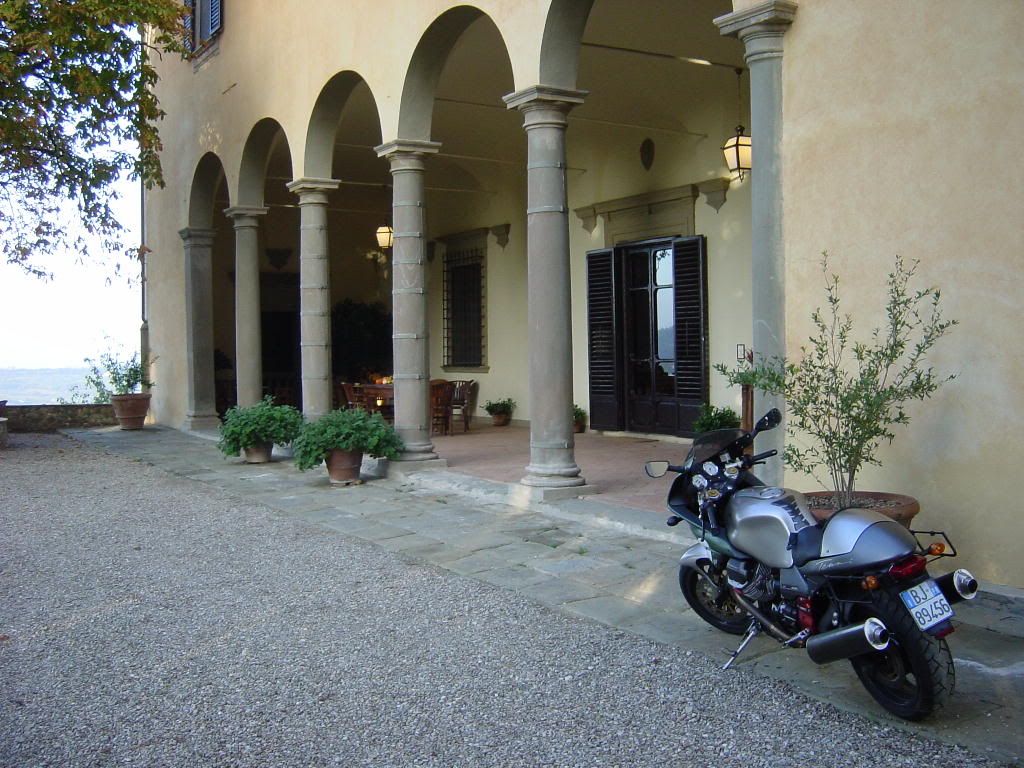
After a long layoff, a plan was hatched for a team orson reunion tour. While Greece was originally considered as a focal point, with team orson still recovering from their injuries and, with the Goose having been in mothballs for almost two years, it was decided to play it safe and stay close to home in an attempt to rediscover sport touring. The team was reunited at team orson world headquarters in Parma, Italy and was soon on the road heading southwards.
Tuscany
The first day would end with team orson in the Chianti region of Tuscany. The long layoff had affected team orson’s endurance and they were feeling mighty sore. In the past, team orson plowed ahead, staying in a new locale every night. A decision was made to stay at one place for a few days, making day trips before moving on.
Panzano in Chianti

Heading southwest from Siena

Someone’s Tuscan weekend bungalow

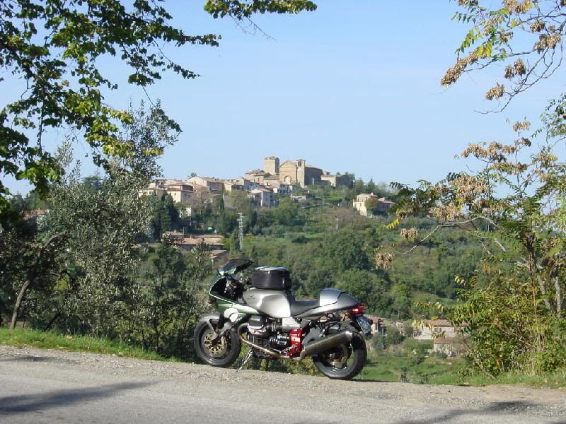
Approaching the castle in Rocca d’ Orcia

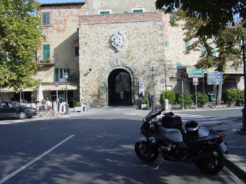
Narrow, cobblestone streets of Rocca d’ Orcia

Heading south from Rocca d’ Orcia, Monti Amiati, the highest peak in Southern Tuscany looms in the distance

Castel del Piano

Tuscan autumnal landscapes

Returning to Rocca d’ Orcia

An elderly gentleman makes his way up the streets of Rocca d’ Orcia. Team orson had been recommended a nice room nearby with an excellent restaurant

Tasty twisties were also sampled

We stopped to have lunch in this town whose name now escapes me.

Team orson was becoming all too familiar with the pleasures of Italian cuisine where, one course simply will not do. Meals were consumed with no concern given to bulging waistlines. At one lunch stop, an Italian waiter chided team orson for ordering a coke rather than wine with lunch. The fact that I was operating a motor vehicle failed to dissuade him from his stance. It was simply un-Italian. Within a week, team orson had to cut out all desserts.
Something was amiss with team orson’s itinerary. Whereas in the past, an innate sense of wanderlust had propelled us onward, now, wandering aimlessly had caused a feeling of disorientation to set in. A chance meeting with a leather shop owner in Siena changed things. After learning that we were both motorcyclists, a conversation about trips and roads ensued. He mentioned the Isle of Elba and how great the roads were there. A seed had been planted and by the next morning, team orson was heading towards the Tuscan coast.
Approaching the coast through groves of olive trees

I had planned to stay overnight at the ferry port of Piombino but, arriving by 3:00 P.M., I found that a ferry was leaving in 20 minutes. I purchased a ticket and was soon directed to the front of the line. I had barely enough time to get off the bike and snap this picture of the ferry before the load master was hollering at me to get my butt onboard

Elba lies 18 kilometers off the coast of Tuscany so, it was a relatively quick 1 hour crossing. The island is about 40 kilometers long and roughly 10 kilometers wide. As with many islands, time seems to slow down a bit and life is carried out at a more relaxed pace than on the mainland. We found a hotel on a beach and made plans to explore the island the following day.
The cove where the hotel was located

The next morning we head west from the main city of Portoferraio, following the coastal highway, Monti Capanne, the highest peak on Elba in the distance

Approaching the town of Marciana Marina on the north coast

The roads of Elba are extremely twisty but, with the heavy traffic, traveling at a sporty pace proved difficult. It seemed that a moped with flip flops and a bathing suit to sample the passing beaches might be the proper choice. After Marciana Marina however, the traffic density was reduced significantly and things began to look up.
When the road broke out of the forest onto the cliffs overlooking the west coast, I was impressed by the view. If you squinted, you might think that you were riding the Pacific Coast Highway in California

Cue Tommy Chong voice: Oh wow man! That’s California!

I stopped in the town of Pomonte for lunch. The primi platti of frutti de mari was absolutely delicious

Unfortunately, the Highway 1 similarity only lasted about 20 kilometers. Heading back east along the south coast

The next day would be spent exploring the east side of the island.
Overlooking the main city of Portoferraio across the bay

Approaching the town of Innamorata

Looking back west along the southern coast from the town of Innamorata

After two days on the island, we boarded a ferry back to the mainland. Heading across Southern Tuscany, the landscape reminded team orson of Spain

It was on this day that team orson would rediscover sport touring. From the coast, the Strada Statale 322 climbs up into the Appenines with a mix of fast, sweeping bends followed by tighter, more technical twisties. Team orson meshed into a single, strada-strafing unit, dispatching what little traffic they encountered to turn the knob to eleven. The day would end along the shores of Lago di Bolsena which, when viewed on a topographical map, is revealed to be the crater of a giant, extinct volcano.
The town of Bolsena is one of those places, lined with trees and cafes and gelaterias filled with Italians enjoying life, that make one think, “Dang, it sure would be nice to retire here”.

Leaving Bolsena the next morning, it’s just a short hop to the hill town of Orvieto

Meandering through the narrow streets of Orvieto

The mighty, mighty Goose patrols the rampart walls for any signs of approaching Honda hordes

Moto Guzzi V11 Le Mans

Lazio
Leaving Tuscany, team orson enters Lazio. While not as famous as Tuscany or Umbria, Lazio still has some wonderful natural beauty.
Heading into the Grand Sasso National Park north of L’Aquila

Team orson was surprised at the quality of the twisties on the eastern fringe of the Appenine mountains. Wonderfully traffic-free, twisty roads that rivaled anything the Alps have to offer. It remains a mystery to team orson why so many focus on the Alps while leaving other fantastic roads untouched but, we are grateful for the lack of traffic
Vast wide open spaces on the northern fringe of Monti Sibillini National Park

The town of Civitella (I think)

Umbria
Approaching Spoletto from the south

Tuscany
After almost two weeks of unflinching, sunny blue skies, a day of rain set in. With time running out, we began to head north towards home base. In Northern Tuscany, the mountains become steeper and the terrain becomes almost alpine-like.
The Northern Tuscan spa town of Bagni di Lucca where team orson found a nice little hotel overlooking the river

Sunny skies returned allowing for a beautiful ride through the Apuan Alps of Northern Tuscany

Resistance is futile. If you see the sign of a scorpion in your mirrors, surrender to your fate at the hands of an Abarth-equipped Fiat 500

More views of the Apuan Alps

Popping out on the Ligurian coast near Portofino

Emilia-Romagna
After a rest day in Portofino, team orson begins the final leg of the trip from the coast back to Parma. Team orson was a bit surprised to find some of the best roads on the trip were within a day’s ride from Parma.
Impressive mountain views in the Emilia-Romagna

The castle overlooking the town of Bardi

One final meal

Route Map:

Mileage: a paltry 3200 kilometers
Riding Days: 17.5
Rest Days: 1.5
Carabinieri encounters: 0
Deer encounters: 0
Ferry crossings: 2
Bee stings: 1
Sri Lanka’s Hill Country
In December 2008, I had my worst accident in over 30 years of riding. It’s been a long, slow climb back to something that resembles normalcy. In almost a year and a half, I’ve experienced more hospital stays and doctor’s appointments to than I care to remember. Now, with the healing almost complete, I was itching to get back out there and enjoy life.
I had originally hoped to fly to Italy to rejoin team orson for a long overdue reunion, but alas, the Icelandic volcano had other plans. I had to come up with Plan B in a hurry. I decided that it was best to get as far away from the volcano as possible, lest I get stranded in some airport. I cast my eyes eastward to the island nation of Sri Lanka. The Tamil rebels had recently given up their decades old separatist struggle, so now seemed like a good time to visit. post haste, I purchased air fare and made bike hire arrangements over the internet.
After a 5 hour flight, I landed at Colombo, the capital city on the west coast of the island. The bike hire guy arranged to have a driver waiting for me, and before long I was at the bike shop. The air was thick with humidity along with the corresponding tropical temperatures. There must still be some tension, as I spotted pairs of armed soldiers at most intersections in Colombo. As the island’s roads are mostly two-laned with lots of traffic, a Honda XR-250 was deemed sufficient for my needs.
After taking care of the pleasantries and paperwork, I was soon on my way, heading north armed with only a map and a camera. Within the first few kilometers, I had missed my turn, so business as usual 😀 A few stops for directions and I was back on the righteous path.
Even luke warm, coconut juice hits the spot on a hot day.

A word about the traffic. I have experienced riding in Goa, so I assumed I knew what riding in South Asia was all about. I didn’t know Jack. Sri Lankan traffic “goes to 11”. As in India, might makes right, with trucks and buses ruling the roads with iron fisted authority. Motorcycles are somewhat lower in the pecking order, somewhere down there with the rikshaws and pedestrians. Drivers had no qualms about pulling out to pass, even with oncoming traffic bearing down. It was the wildest game of chicken I’d ever seen. As such, I occupied the 6 inches of tarmac closest to the shoulder, and at least on one occasion, I took to the dirt apron to avoid becoming a hood ornament :crazy: No one batted an eyelash at such shenanigans as it was just the way things are done.
The tuk-tuks were the worst. Little, three-wheeled vespa taxi cabs. These guys were insane, making U-turns without looking or pulling out into oncoming traffic. Besides that, they were so slow, they always had a string of cars waiting to pass, leading to impatient drivers to make dangerous passes.
May is the beginning of the wet season, and by mid-afternoon, the skies had begun to darken. Before long, the showers came. I sought refuge in a roadside Buddhist mini-shrine with a few other local bikers.
Rain delay

Maybe it was because I hadn’t ridden in so long, but the XR’s saddle felt like a rock. If the XR was the last bike left in the world, I would give up riding. It wuz that hard.
Fortunately, the showers didn’t last long and I was back on the road to Kurunegala. There was a giant, golden Buddha on a hill top, but I couldn’t get close enough to get a good picture. I continued on to Habarana, my stop for the night. I found my hotel just before dark and enjoyed a hot shower along with adult beverages and dinner.
The next day, I would begin the climb into the hill country. Along the way, I passed several elephant safaris.

When I stopped to snap this picture, a tout ran out and insisted that I must ride the elephants. I was equally insistent, that I must reach Kandy before the afternoon rains 😀 Most Sri Lankans I encountered were gracious hosts. As in India, if you flash them a big smile, you are almost always repaid in kind. I passed several police checkpoints, but they seemed uninterested in foreign tourists.
I made my way to Sigiriya, a World Heritage site. Sigiriya holds the ruins of an ancient fortress built atop a rock of hardened magma.

Another giant Buddha near Sigiriya

Many people don’t realize that South Asian culture is even older than that of ancient Egypt. With my bad hip, I was unable to make the climb to the top of Sigiriya, and was back on the road, climbing towards Kandy, the capital city of the hill country.
Numerous roadside stalls sold all manner of coconuts, bananas, mangos, papayas and other fruit I didn’t recognise.

Giant trees stretched outwards in all directions offering copious amounts of shade
I didn’t quite make it to Kandy in time before the afternoon rains, so once again, I sought shelter, this time in a bus stop. After about an hour delay, I continued towards Kandy, with traffic getting progressively worse. By the time I made it to the city limits, traffic was pandemonium. I just wanted to get to my hotel and take a hot shower. Looking down, I happen to notice the key was missing from the ignition 😮 Now I had to be extra careful not to stall the bike before I reached the hotel.
After some searching, I finally located my hotel and called the bike shop. Amazingly, someone had already found the keys and called his number on the key fob. As I was too tired to backtrack, I made arrangements for a driver to go retrieve the keys for me.
The view from the hotel room overlooking the river

They tell me that the film “Bridge Over The River Kwai” was filmed somewhere in the Sri Lankan hill country.
The following morning, I headed out towards the town of Nuwara Eliya, a former British colonial enclave surrounded by tea plantations. The traffic in Kandy was still terrible, and it took me 45 minutes just to negotiate my way out of town. Once I got away from town, traffic lightened up considerably and I was actuall able to strafe some twisties. The thought of a bus passing on a blind corner kept me from getting too frisky.
The road to Nuwara Eliya

I decided to take a different way back to Kandy

Seeing an elderly man walking on the scorching hot pavement in his barefeet reminded me of what a soft piece of milquetoast I am.

More giant shade trees

Hill country views. Some trees were blooming fiery, red flowers

Terraces and drying laundry

Another hill country vista. Even on these narrow backroads, you would still encounter the malevolent buses

Another river crossing

Back in Kandy. Kandy had a nice town lake with a walkway and park benches. Families were out enjoying the weekend.

After 2 nights in Kandy, it was time to return the bike to Colombo. I left Kandy and made my way down towards the coast.
Low country images

I came upon a woman with 2 porcupines. I asked if they were good eating, but she said no. They seemed docile enough, but I wasn’t gonna stick my hand in front of their faces to see what would happen.

Leaving the hill country, the terrain changed from terraced tea plants to rice paddies

One of the dreaded tuk-tuks approaches in the distance, searching to create some form of mayhem

After getting lost one more time, I ended up having to call the bike shop, and he came and rescued me. All in all, I managed to survive the crazy traffic and rainshowers to have an enjoyable time.
2004 Portugal To Croatia
Starting out at my friend’s house near Porto, Portugal where my bike spent the winter months, I traversed southern Europe to reach the fortress city of Dubrovnik, Croatia. Whatta trip! 5600 miles / 9000 kilometers. 26 riding days, 3 rest days. I left Porto & headed east following the Duoro River. The road hugs the river & meanders through Portugal’s famous port wine growing region. It reminds me a lot of the road along the Mossel River in Germany. It definitely merits mentioning as one of the most scenic drives in Europe. I followed the river as far east as possible, almost to the Spanish border before turning south to check out the Sierra de Gredo. A smallish mountain range near Madrid.
Along the Duoro…

From the Sierra de Gredos, I turned north, towards los Picos De Europa. Across the Principality of Leon, the land turns flat & featureless. This terrain along the Duero was where the border between the Moors & the Christians stabilized for about 100 years. As such, the region is chock full of castles & fortresses as both sides sought to fortify their positions. After passing through the city of Leon, the terrain started getting interesting again as I approached los Picos De Europa. I enjoyed Los Picos so much, I ended up staying a couple days in Riano.
Approaching Riano

Another shot of the tasty asphalt in the Picos De Europa

Whereas last year, I enjoyed picture perfect weather, this year was spent under the threat of rain. While I probably actually rode in the rain less than 10% of the trip, the ominous presence of dark clouds cast it’s shadow over the first 2 weeks. Here is another shot of threatening skies in los Picos.


From Los Picos De Europa, I hugged the coastline along the Costa Verde towards the Pyrennes. I see what they mean by Costa Verde. I saw some spots greener than green. Every tree, shrub, bush & blade of grass was the exact same hue of green creating a “green out” effect. I crossed the Pyrennes at the Col du Somport. The weather was damp & foggy so…sorry, no pictures of the Pyrennes this time
I crossed the south of France using all the back roads. I saw one road on the map that followed a river so, it seemed like a good choice. It ran between Montauban & Rodez. I’ve mentioned before that I believe the French have some of the best motorcycling roads around. This road had some sweepers like I’ve never seen before. Lean right for 20 seconds, lean left for 20 seconds & on & on. It seemed surreal. I exited that section just shaking my head.
The French road engineers are true artisans. Here is another picture from the south of France. Mind blowing billiard table smooth constant radius 3rd & 4th gear sweepers. Just take this picture & multiply it by miles & miles. You get the idea.

Continuing to work my way across southern France was hard work!

Approaching the Maritime Alps on the French Italian border

When I got near Italy, I felt I had to choose between the Alps or Croatia. I sat at the fork in the road for about 20 minutes studying the map, pondering my options & arguing with myself I finally chose Croatia. Years ago, I had read an article in a car magazine that likened the coastal road in Croatia to California’s Highway 1. Seeing that Highway 1 is my all time favorite road, I was keen to sample the comparison. I blasted across northern Italy via the Autostrada in a bid to save some time but, after a half day of droning, I’d had enough. I veered north towards the Dolomites. In Merano, I took a well deserved day off to plan my attack of the Balkans.
I crossed over into Austria briefly before entering Slovenia via the Wurzenpass through the Julian Alps. Slovenia is a wonderful little country totally covered with mountains & with friendly people. The women seem to be an exquisite blend of German & Italian. The men…well, they looked like men to me 😀
The Wurzenpass.

The Julian Alps near the town of Bovec, Slovenia

I entered Croatia after a cursory passport check. No problems getting in. Croatia lies but 15 hours from Germany so, they are used to German bikers vacationing there. I had to make do with a cell phone advertisement for my “Welcome To Croatia” sign 😀

Making my way down the coast, the clouds seemed to be following me so, this clouded my perception of any comparisons with Highway 1. Here is a shot of the town of Rogoznica, totally covering a tiny peninsula. Lots of towns with strange sounding names like Zog seem to be places that might be ruled by Ming the Merciless.
Oh yah, the Goose sits in the foreground impatiently sitting through another photo session. Does this look like a bike that likes to sit around all day? No siree, Bob. She’s straining at the bit, raring to get going :naughty:

Right after this picture was taken, I suffered my biggest scare of the trip. A baseball sized rock materialized before me as I was waiting to pass a car. It glanced off my front tire & whacked my oil pan. I pulled over to check the damage. To my horror, the oil pan had a big chunk knocked out of it & it was dripping oil on the ground. I had remembered seeing an Aprilia sign a few miles back so, I turned around & headed back. The Aprilia shop couldn’t help me but, they knew a mechanic who could. I left the bike with him & took a hotel room. The next morning, he came & picked me up & took me back to the shop. He’d done a good job & patched the Tenni back up. Total lost time- 24 hours. Not bad. The roads in Croatia were pretty rough & uneven. My arm/shoulder sockets ached so bad by the time I got to Dubrovnik, I had trouble sleeping one night. All in all though, I’m glad I went.
I thought it would take about 5 days to reach Dubrovnik. It only took 2. Ooops…so much for good planning. Oh well, this provided me with more time to explore the coastal island chain.
Dubrovnik was shelled by the Serbians during the recent war but, the Croatians have done a great job repairing the damage. The place was full of vacationing Europeans. I saw buses from Poland, Hungary, Estonia and about a bazillion Germans. It seems the Croatia is the next south of Spain. The coastline is still wonderfully undeveloped. The Croatians are sitting on a gold mine. I just hope they plan well & don’t end up ruining it as they have the south of Spain.
The mighty mighty goose surveys the fortress city of Dubrovnik


An abandoned section of the old Adriatic coast highway just south of Dubrovnik

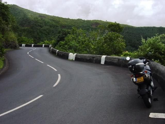
Heading back north, I began island hopping along the chain of coastal islands. The coastal islands are served by a whole fleet of ferrys making it easy to go from one island to the next. My favorite was the Island of Brac. A little gem of a rock full of sleepy little fishing villages. Oh…and great twisty roads made it seem like my own little Isle of Man…uhm until the local gendarme flashed his blue lights at me. oopsie
Here is a pic from Brac overlooking the little village of Povlja.

Overlooking another village on the Isle of Brac.

The fishing village of Milsa on Brac where I had a nice lunch of risotto dyed blue with octopus ink

Turquoise blue Adriatic off the southern end of the Isle of Cres

From Cres, I rejoined the mainland on the Istrian Peninsula, prized by the Romans for the quality of their olive oil. On the southern tip of the peninsula lies the town of Pula. The Roman amphitheatre at Pula is the sixth largest surviving Roman arena.

Heading north from Pula along the west side of the peninsula, I ran into tourist trap hell & the traffic that goes with it. I gave up on following the coast & headed inland. Much nicer. This is a fertile peninsula and was dotted with scenic farms.
I re-entered Slovenia, spent a couple days in the Julian Alps. I found that I still had 4 days left so, that left me a few days to play in the Italian Dolomites. I couldn’t believe how many bikes I saw in the Dolomites considering it was the middle of the week. The place was crawling with German & Austrian bikers.
On my second to last day, I spent rampaging through the passes around Cortina de Ampezzo. At around 4 P.M. I was passing through the town of Corvara when I felt a sudden shudder from the rear end. My first thought was that I had a rear flat. Upon dismounting, I found the tire to be fine. Hmmm. Seems the rampaging through all the passes had wasted my rear wheel bearing I made a call to my bike shop in Parma & we devised a plan. I would leave my bike at one of his friend’s house nearby then catch a train to Milan to catch my flight to Saudi. He would drive up later & pick it up. soooo, I wuz robbed of my last day of riding. I really can’t complain though. After a month on the road, I was well & truly spent. I was extremely fortunate the bearings gave out while I was going thru a town. It would have sucked to have broken down high up a mountain pass as the sun was going down.
This was my second rear wheel bearing failure. Both going out at about the 17,000 kilometer mark. Other than that, the Guzzi performed like an Abrahams M1 tank. Never missing a beat during the whole adventure.
Here’s a shot from the last day in the Dolomites.

Tuscany I
November ’04
I had scheduled the first week in November to get one last ride in before the onset of winter in Italy. My intention was to take it easy, take some pictures of some picturesque Tuscan villages & generally putter about with no general sense of urgency. As the trip grew nearer, I kept checking the weather on the internet in hopes that there might be some glimmer of fall left. My hopes kept getting dashed upon the rocky shore of reality as, each time I checked, all I could see was a line of icons showing gray clouds with little rain drops eminating. I kept checking again and again in hopes that the weatherman had made a mistake or the weather had taken a turn for the better but, alas, nothing but rain clouds appeared for the entire week. As I already had purchased a plane ticket, I decided to go ahead and try to make the best of a damp situation. I flew into Milano, hopped onto a train to Parma & checked into my hotel. Parma is a nice city with many sights to see including a fantastic rennaisance era theater. However, that wasn’t what I was here for. Things looked grim as I woke up the next morning and heard a thunderclap which was followed by a rain shower.
I headed for the bike shop like a man headed to the firing squad. As I prepared the bike, the rain had stopped but, the skies were still gray. It was almost 12 noon before I was ready to get under way so, I made the decision to slab it down to Florence on the autostrada (interstate). This decision was also due in part to the fact that BIKE magazine had rated the autostrada between Bologna & Florence as one of the best rides in Europe.
Around mid-afternoon I began to see vague shadows appear. The skies were getting brighter though, they were still gray but, hey, the roads were drying up & I was riding my bike. Things could be worse. As for the autostrada’s great rating? I was less than impressed. It was still an interstate to me though, it did have some curves thrown in. I guess the interstates west of Denver would be comparable. The view was quite different though. Pure Tuscany. Italian pines dotted the landscape looking for all the world like the backdrop to a Leonardo Da Vinci painting.
By late afternoon, patches of blue began to appear. Hey! What is this? Maybe I’ll get lucky. After missing my exit and going 50 km before stopping to check the map (eyeroll) I managed to find my way to the villa I would be staying at in San Casciano, just south of Florence.
Here is a photo of the Villa Il Poggialo. This would be my home for the next 2 nights. Kinda looks like what a Tuscan villa should look like, huh. It’s a family run place & me and my Guzzi were made to feel more than welcome. It felt like I was staying at someone’s house. Well, it did used to be the family’s house.
I woke up the next morning to a vibrant blue sky. Bonus! The weatherman was obviously still asleep. After breakfast, I loaded up & headed south through the Chianti foothills towards Siena, the smell of harvested grapes heavy in the air. Since I was sticking to the backroads & the towns I would be going through were centuries old, I expected that the roads would also be centuries old. WOW! Was I ever wrong! The roads were fantastic! Imagine two parts Napa Valley, one part Deal’s Gap, set the blender to “liquify”. Enjoy! I did just that! The roads dipped and weaved through breathtaking scenery & this time of year there was hardly any traffic.

Picture of a Tuscan farm house. I’d love to live here but, the Brits have bought up all the property driving the prices sky high.

Quite possibly the bike industy’s most beautiful sport tourer, the Le Mans stops to take in the view near the village of Radda in Chianti. 🙂
stopped for lunch in the scenic village of Monte San Savino. I ate at the little bar / gelateria across the street. It’s against my religion to eat at a McDonalds in Italy. It’s impossible have a quick meal here. If you try to get by with just one course, they look at you kinda funny. Count on spending 1 hour to have a nice meal. Well worth it!
The view from the other side of the portal. Itty bitty Italian cars were zipping through the portal at a frightening clip (frightening for me at least).
After lunch, I turned back, going through Siena, then north thru Colle di Val d’Elsa. Here is a picture from outside the city walls.
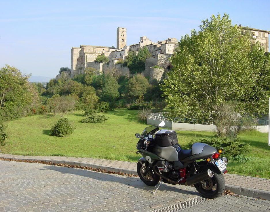
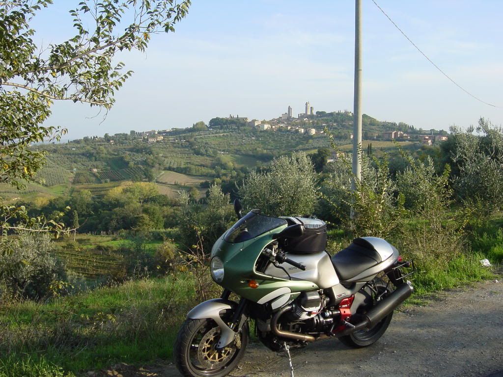
The mighty Goose pauses near the town of San Gimignano. San Gimignano is a tourist hot spot as it is reknown for its famous towers. I was cruising the back streets when I came into the main “pedestrian only” throughfare. Imagine their surprise when a Guzzi mounted hoodlum hurtled into their midst. Realizing my mistake, I did a quick U-ey, leaving the dazed tourists to wonder,”who was that masked man”?
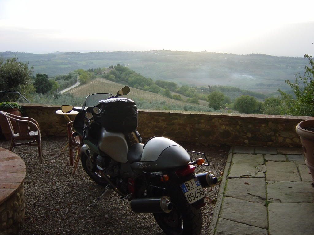
I ended the day back at the villa. What a gorgeous day it turned out to be! 70 degree temperatures and fabulous roads too! I sat on the veranda with a glass of port wine watching the sunset go from pale blue & hot pink to pale blue & crimson over the Tuscan hills.
I was to be blessed with more blue skies on my third day! On this day, I headed to northern Tuscany where the Appenine mountains lie. The roads got tighter and slower but, the scenery was more of the same. The Appenines climb as high as 6000′ making for cooler riding but, at least it wasn’t raining, causing me to tip toe thru the curves so, I wasn’t complaining. Temperatures hovered in the high 60’s low 70’s.
Here near another picturesque village called Cutigliano, the exotic Goose pauses for a breather. 🙂
I’m sorry I couldn’t take pictures of almost half the beautiful sights I saw. Most of the time the road was just too narrow to safely pull over and snap a picture. Y’all are just gonna have to go there & ride it yourself 🙂
In northern Tuscany, the Guzzi overlooks the town of Barga with the Apuan Alps in the background.
Last one. This one’s called,”take the long way home”.
Descending from the Appeniness down to the plains of Parma, the roads opened up & became faster & sweepier. Good stuff! A good way to end the trip. Unfortunately, all trips have to come to an end. This one was much too short but, I cheated the weatherman by getting 3 days of glorious blue skies so, I can’t complain. Tip toeing thru wet curves sucks.
Mileage: 1100 km in 3.5 days
Reunion Island
Recently, a co-worker of mine had talked about living on Mauritius, an island in the Indian Ocean. Intrigued, I decided to do some research on the subject. I googled a map of Mauritius, when I noticed another island nearby. I discovered that it was Reunion Island. Why hadn’t I noticed it before? I had read vague references to Reunion, but had never paid it close attention. Why was Mauritius relatively well-known and Reunion under a veil? The reason is that it is a French possession. It is a French overseas Department just like French Surinam in South America.

Reunion is a volcanic island that has been compared to the big island of Hawaii. Apparently, the French don’t appear too keen on sharing their version of Hawaii with the English speaking world, thus they have thrown a cloaking device over the island. I’ve always been impressed by the quality of French road system and a Hawaiian-like island with French maintained roads seemed too good to pass up.
I set out to try to organize an expedition. It proved to be harder than I thought. The only direct flights to Reunion come from Paris or South Africa. Any other flights had to be made to nearby Mauritius, where a puddle jumper could fly you over to Reunion. They weren’t going to make it easy for me. Hotel reservations sent via the hotel’s web page went unaknowledged. The same with any bike rental web sites. Not to be deterred, I finally found e-mail addresses and sorted a room and a motorbike, and everything was arranged.
A six hour flight south out of Dubai got me to Mauritius, where I boarded a small prop plane to Reunion. Arriving in the capital city of Saint Dennis around noon, I made my way to my hotel and rested until the following day when I would pick up the bike. I had arranged to rent a BMW GS 650, the same type of bike I had used on Madeira a few years ago. Herve was the owner’s name who ran a one man operation out of his house. Why people would want to rent out bikes to people who are going to thrash them is beyond me, but I’m thankful for them 🙂
While Reunion has some nice beaches, it’s the island’s interior that stand out. The island’s geography is dominated by three calderas, created when an ancient volcano collapsed. The collapse left huge natural ampitheaters with stunning scenery. I made my way south along the west coast of the island towards the first caldera known as the Cirque de Cilaos where I had booked my hotel for the night.
Tropical cyclone Lola was close enough to the island to lash her with scattered showers, so under the threat of rain, I found a suitably twisty line on the map and headed south along the west coast of the island.
Heading south:
The main road around the island hugs the coastline and is fairly crowded, but I used it for a bit in order to make some time.
At the town of Saint Louis, I turned inland and started to make the climb towards the town of Cilaos. You masochists who love switchbacks would love this road as it was packed with them.
Looking back down at where I’d been:

Continuing the climb to Cilaos, I was impressed by the island’s mountainous terrain
The little beemer proved to be well suited for these roads. My impressions of the GS are the same as the ones I had from my previous rental. The single cylinder engine could use a few more ponies, but the wide bars and the comfy saddle make for a good combination of a touring motard, nice and light to flick thru the tight stuff.

I found my hotel and settled in for the night. Sugar is one of the island’s biggest crops and with that comes rum. One of the favored spirits on Reunion is rhum arrangé. This is rum that is left to soak in a variety of fruits. Every establishment seems to have their own concoction which they insist is the best and you feel obligated to try some, which is served straight up like a brandy. In the interest of impartiality, this reporter took it upon himself to sample some at every occassion and was particularly in favor of the orange-pineapple blend 🙂
The following day, I set about exploring the narrow roads inside the Cilaos caldera
By noonish, the clouds had descended again, and I began to feel rain drops. In the interest of staying dry, I cut short the explorations and made my way back to the hotel for more rhum. While reading my guide book, I noticed a section that mentioned,”Avoid travelling to the cirques during times of typhoons, as frequent landslides occur from the excessive rainfalls, causing the towns to be sealed off for days.” A little too late for that now! Reunion Island is known for its prodigious amounts of rainfall, holding world records for 12 hours, 24 hours, 1 week, 1 month, and 1 year totals.
The morning of the third day, I awoke to the sound of the pitter patter of raindrops on my window. I decided to tough it out and head for the coast, hoping to find better weather. It was a 1 hour slog thru a misting rain back down to the coast, but fortunately, the weather began to improve.
I headed south along the shore towards the island’s remaining active volcano, the Piton de la Fournaise.
Unfortunately, team orson’s photographer decided to store his camera in the front pocket of his jacket during the rain, and the camera started to malfunction. I honestly don’t know why we keep the idiot around. So, there are no pictures of steam arising from the lava fields on the south coast of the island.
Instead, here is an artist’s depiction of the road cutting along the coast thru the laval fields with steam rising
Fortunately for team orson’s photographer, the sun began to work its charms and the camera began working again. Banana trees and mountains. Typical Reunion island scenery.
Heading up the eastern coast to the town Saint Andre, I hung a left and made my way up into the hills to the second caldera known as Cirque de Salazie. The word awesome has been severely overused in today’s lexicon, but the road heading up to the town of Hell-Bourg is truely awesome.
This was a truely amazing road reminiscent of the Norweigian fjords or Yosemite. While the road itself wasn’t the best, the scenery more than made up for it. It may not a match for Norway or Yosemite, but it was purdy darn close.
Waterfalls dotted the landscape:
and sprinkled the roadway
Looking up towards the Piton des Neiges, the extinct volcano that is the island’s highest peak at 10,069 feet.
Looking back towards the coast. The road to Hell-Bourg comes up the canyon and around the bend
After securing a room in Hell-Bourg, I took advantage of the clearing skies to take some more photographs during the golden hour. This would be my best day on the road as I rode all the way til sundown enjoying the spectacular views.
Another look at the Piton des Neiges.

Hell-Bourg isn’t named after hell itself, but rather Monsieur Hell, who was a French government official overlooking the island during the 1800s. On the morning of Day 4, the skies were clear and I took a look around the town. The Creole architecture of main street with the Piton des Neiges in the background.
Hell-Bourg has been called one of the most scenic French villages and rightly so.
Many of the homes were designed in what is known as Creole style. Notice the huge ferns in the front yard.
Heading back towards the coast…yet another waterfall

Ok ok ok…another waterfall…we get the idea…sheesh
Many of the peaks would be veiled in clouds by midday, as if to say,”Foolish mortals, do not tread here, for here lies the lair of the skid demon”

All that rum has to come from somewhere. Sugar cane fields stretched for miles and miles, resembling Hawaii.
All the signs in towns were in French and few people spoke any English, putting my high school French to the test. In the town of saint Andre, I came upon a Hindu temple and my brain did a backflip. It had to take a few seconds to figure out where I was. The South Pacific? India? France?…oh right, I’m on Reunion Island. It was a strange place in that way. The people were a mixture of French, African, Indian, Malaysian and Chinese. I have to say, I never encountered any of the French gruffness that sometimes seems prevalent on the continent. Everyone I came across was pleasant and smiling.
Perhaps due to the copious amounts of rainfall, almost all the secondary roads had big water channels along side them with no guardrails. Woe unto the motorist who loses his concentration for a moment.
Clip that apex, just don’t clip it too close!
There is only one road across the center of the island, and a great riding road it is! In the highlands, the temperature dropped into the high sixties and the terrain began to look a lot like the north of England. Again, my mind had to stop for a moment and remind me that I was on an island in the Indian Ocean.
Now that the weather had turned to mostly sunny skies, I decided to return to the Cirque de Cilaos to get some more pictures.
The road heading up to Cilaos:
Inside the Cirque de Cilaos
Morning dawns in the town of Cilaos on Day 5:
Heading back down towards the coast:


Approaching the coast, the terrain turned to gentle hills dotted with palm trees and sugar cane fields.

I headed back up the east coast back towards the capital of Saint Dennis

Stopping for a plate of Creole barbeque. No I didn’t finish it all, but I tried!
The food was a mixture of French, Indian and Malaysian. Boy, did I eat on this trip! Some of the meals had 6 courses. Only the French could invent a mini dessert placed between the apperitif and the main course. A small portion of coconut ice cream swimming in a bath of…you guessed it…more rum.
On the sixth and last day, I would return the bike to Herve, but not before checking out some of the Creole architecture in Saint Dennis:
I had a great time riding through some amazing scenery. While the roads may not have been up to the standards of the French roads on the continent, the scenery more than made up for any deficiencies. The little beemer again proved to be a perfect bike for riding tight island roads. Hopefully I’ll be able to test the new BMW 800 GS soon. I would have to grade Reunion as a solid A as a touring destination. Friendly people, challenging roads, good food, and stunning scenery.
Recap:
Time: 6 days
Distance: approximately 1000 km
Gendarme sightings: 2 (both times on motorbikes, both times going faster than me.
Puckers: 0
Bee stings: 1
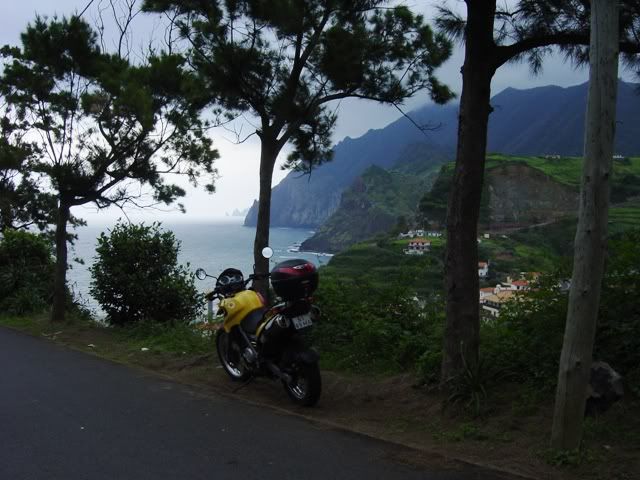
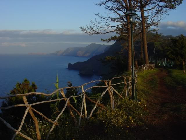
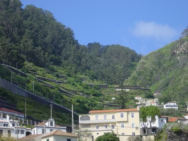
Madeira, Portugal
April ’06
Madeira is a Portuguese island in the Atlantic approximately 300 miles off the coast of Morocco. I first read about the island’s beauty about 20 years ago. It must have been from a motorcycle magazine because that’s all I read back in those days. I had my first visit two years ago when I travelled there with the girl friend unit. Although we were in a rental car, I was impressed with the twisty mountain roads and made a note to myself that I must return and ride the roads on two wheels.
Last week, I got my wish. I made arrangements to rent a BMW 650GS and explore the island’s backroads. Only 36 miles long and 18 miles wide, Madeira squeezes in some of the world’s most breathtaking scenery. Dramatic mountain peaks and valleys tumble down to an ocean covered in an abundance of exotic flowers.
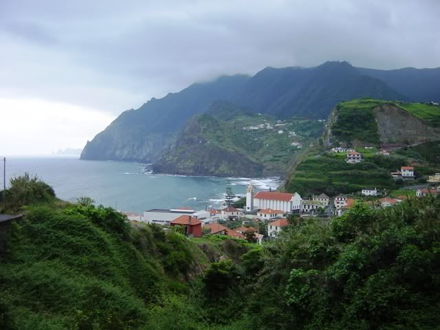
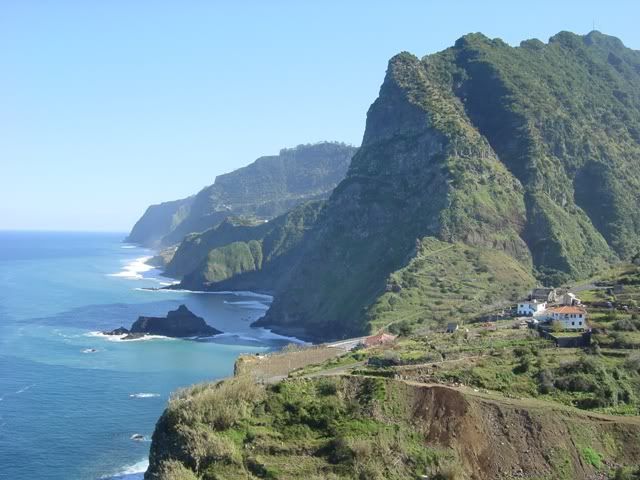
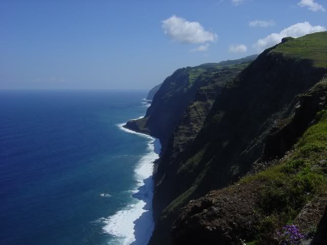
Overcast skies greeted me on my first morning as I took delivery of the bike. Not wishing to risk rain in the central highlands, I headed for the north coast, skirting the mountains. Even though I was avoiding the mountain peaks, the road was still pleasingly sinuous. My first view of the northern coast was from the ridgeline high above the sleepy fishing village of Porto da Cruz.
Dropping down into Porto da Cruz under overcast skies.
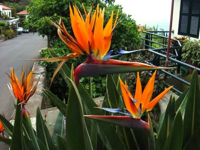
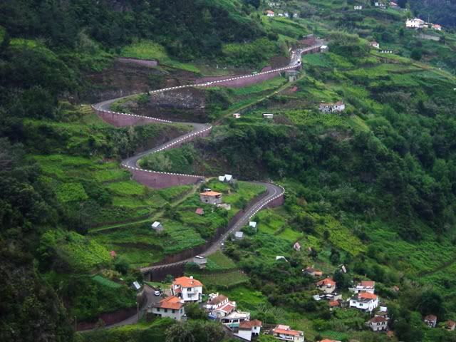
From here, I would snake my way along the treacherous coastal road. Before the influx of European Union funds helped build a modern highway system, this was the only way to travel from town to town. Now, they have built a modern freeway comprising of a series of tunnels that greatly reduces travel time. While most of the locals use this modern, new highway system, this leaves the old road free for local villagers and motorcycle-crazed foreigners. If you’re a flower lover, it would be impossible to ride these roads. You would wind up so overcome by the intoxicating display of flora that you would soon drive off a cliff. Passing through small towns, dogs claimed patches of roadway as a good place to take a snooze, testament to the amount of traffic. Old men feigned indifference, as if they hadn’t been sitting and watching traffic go by for the better part of the morning.
Native Flora. These bad boys were growing all over the island.
The little Beemer proved itself well suited to the Island’s rugged terrain. As most of the island’s backroads were so twisty, the 650cc single cylinder Rotax powerplant was more than capable. What little slow moving traffic I encountered was dispatched with alarming alacrity, with the engine emitting a properly angry exhaust note. During the short spurts on the island’s freeway, the bike easily kept up with all but the fastest four wheelers. The heated grips proved to be a blessing in the highlands of the interior and the suspension absorbed the sometimes rough patches.
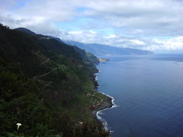
Looking westward along the northern coast, a torturous road heads inland.
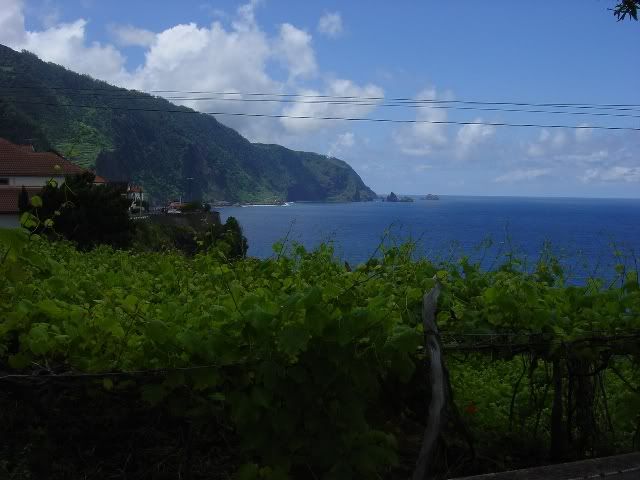
I found a seaside hotel near the town of Santana with awesome views of the coast so, I decided this would be a good place to stay the night. The small dimensions of the island meant that each nights stop might only be some 5 miles from the previous night’s stop. Even so, I still managed to burn up a tank of gas a day. The skies cleared at sunset providing a promise for better weather to come.
The view at sunset from the hotel’s walkway.
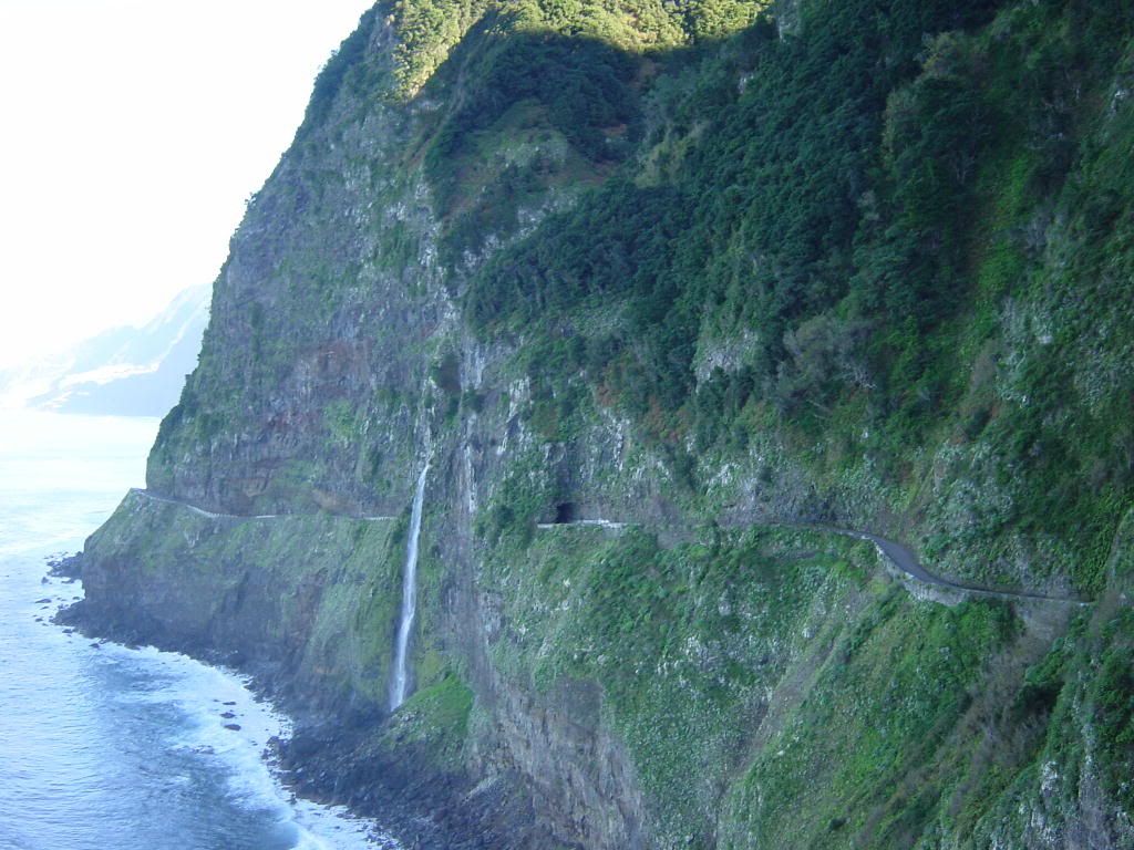
The following night’s destination would be another quaint fishing village on the northern coast named Seixal, in the heart of the famed Madeira wine growing area. I followed the coastal road but took every opportunity to explore any roads I encountered heading up into the mountains. These inland roads provided scenery just as dramatic as the coastline. Mountainous terrain shot straight up into the sky at dizzying rates. Farmers took every chance to cultivate any plot of available terrain, with terraced plots in every conceivable nook and cranny.
Road heading inland.
The coastline near Sao Vicente.
Some of these backroads had also benefited from E.U. funds with a new coat of pavement making for some great curve strafing. Thank gawd for the E.U. funds. The last section of coastal road before reaching Seixal was clawed from the precarious cliffside making for a dramatic view of the Atlantic. I enjoyed this section so much, I returned and rode it again at a somewhat more spirited pace. Discretion being the better part of valor, my throttle hand managed to keep a prudent rate.
The road to Seixal.
Finally arriving in Seixal, I made my way to the bed & breakfast, my home for the next 2 nights. It was a charming place overlooking the small harbor, built in 1867 and recently renovated. I enjoyed the local favorite, blackfish with banana along with some of the local wine. I left the windows open taking in the fresh ocean breezes and fell asleep to the sound of the crashing waves below.
After a refreshing night’s sleep, I decided to make my way around the west coast of the island. By mid-morning, the ocean mist had burned away and I had clear blue skies. Porto Moniz lies in the Nortwest corner of the island. They have some neat salt water bathing pools amidst the crashing waves. Purdy cool. From Porto Moniz, the road climbs straight up.
The road climbing out of Porto Moniz.
Before long, it seems as if I had been teleported directly to Northern California. The road cut a path through a grove of eucalyptus trees looking for all the world like the section of the Pacific Coast Highway just north of Bolinas. Of all the places I’ve ridden, this section came the closest to matching the PCH for twistyness and beauty. Unfortunately, it only lasted for a few kilometers. The entire stretch of road along the western coast was extremely twisty yet traffic free. Even when stopping to take pictures, it was rare to see even one vehicle go by.
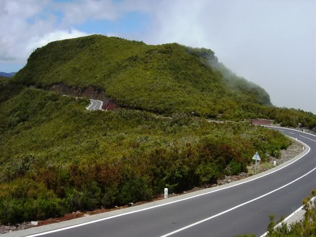
I returned to Seixal via the inland route across the highlands. The interior of the island resembles the Scottish highlands with no trees and scrub vegetation. The roads here also opened up vaguely reminding me of the mountain section of the Isle of Man TT course, bringing out my inner Mike Hailwood. Ocean mist rising along the coastal ridges and white marker posts added to the TT effect and only served to fuel my Mike the Bike fantasies.
Releasing my inner Mike Hailwood.
The next day would unfortunately be my last on the island. I had a 5:00 P.M. flight back to Lisbon so, I had to have the bike back by about 3:00 P.M. I took another route from Seixal across the highlands to the center of the island. The going was a bit chilly at the higher elevation but not enough to deter my progress. Approaching Funchal, I made a quick detour to the inland town of Curral das Freiras. What a great decision that turned out to be. The town lies in the middle of a dramatic valley that resembles Yosemite. Valley walls rise up in all directions to dizzying heigths. Unfortunatley, team orson’s ever-whining team photographer had allowed his camera’s memory to run out! So…no pictures from Curral das Freiras. 😦
Another road winds its way along the northern coast.
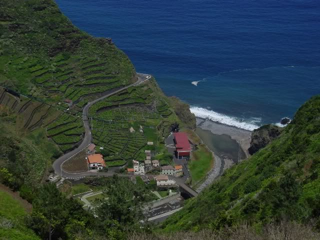
Typical winding inland road.
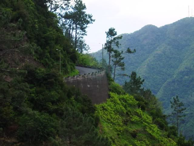
I made my way back to Funchal only to get myself lost on the city’s backstreets. This was great! I was going to miss my flight and get fired for being late back to work! Finally, I was able to come upon the freeway and managed to regain my bearings. With military-like precision, I pulled into the bike rental place with minutes to spare. A quick jaunt to the airport and I was soon being whisked on my way back home.
All in all, with it’s incredibly scenic coastline and wonderful array of flowers, Madeira makes for a terrible motorcycling destination. With all the distractions, it’s difficult to keep your eyes on the road! Therefore, I’m afraid I can’t recommend Madeira as a motorcycling destination. It’s bad. Don’t go there.
Map of Madeira.
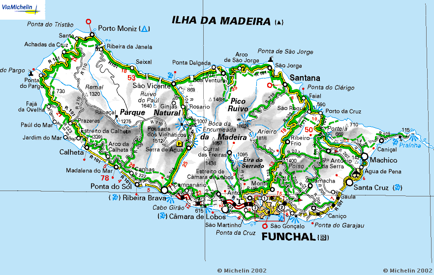
Italian Lake District
Fall 2008
team orson managed to get one last ride in before winter’s icey tendrils gripped the Italian landscape. We decided to stay close to home and explore the Italian Lake district in the foothills of the Alps. After retrieving my Guzzi from Moto Guareschi in Parma, we made our way north via the backroads under sunny blue skies.
The first lake encountered would be Lake Garda. The southern end of the lake is a bit touristy, including the kitschy Gardaland, an italian takeoff on Disneyland. However, once you head north along the lake shore, you encounter many quaint villages, some with their own medievel castles.
Stopping for a leisurely lunch at the town of Garda on the east side of the lake.
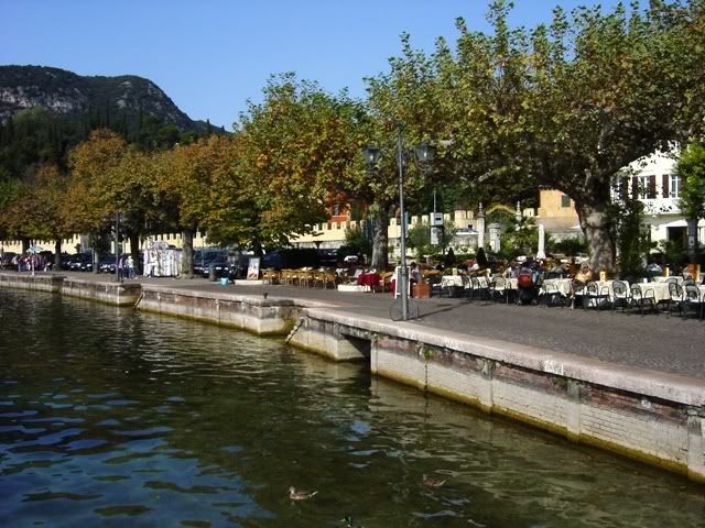
Climbing up into the hills that surround the lake provide a better view.
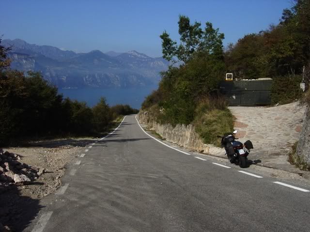
At the north end of the lake, in the town of Arco, stands the imposing 12th century Castello di Arco.
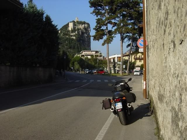
Heading south on the western shore of Lake Garda, the road spends half the time cutting thru tunnels due to the steep cliffs.
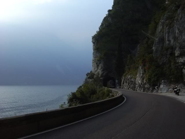
The plan had been to head west towards Lake Como. However, at a gas stop in the town of Storo, just west of Lake Garda, the Goose began running on one cylinder. Fortunately, there was a car/motorcycle garage right across the street. The mechanic couldn’t do anything for me, but offered to load up the bike in his truck and take me to the Guzzi dealer in Rovereto.
I found a hotel room for the night and returned to the Guzzi shop the next morning. As they weren’t making any headway, they offered to let me take a new Moto Guzzi V7 for a ride. never one to turn down a free test ride, I jumped on it before they had any second thoughts. I headed southeast from Rovereto on SS46 thru the Passo Piani di Fugazzi. This is quite a spectacular pass with freshly paved tarmac and the little Guzzi performed admirably. Unfortunately, it had no place for my camera, so no pictures 😦
Returning to Rovereto, they were still having no luck diagnosing the Guzzi’s electrical problem. With the weekend looming, I didn’t want to be stranded, so I called Mr. Guareschi to come rescue me, since I was only 2 hours from Parma. For those who haven’t heard of him, Papa Guareschi is to Moto Guzzi as Pops Yoshimura was to Suzuki 🙂
Returning me and my Guzzi to Parma in his van, and seeing the next day was a Sunday, he kindly offered me the use of his new Moto Guzzi Stelvio. Top bloke. I stayed in Parma the night before continuing my vacation the following day.
Not willing to lose any more precious time, I blasted north to Lake Como via la autostrada. Lake Como is the spiritual home to Guzzisti the world over. Every Guzzisti is required by his faith to make the pilgrimage to Lake Como at least once in his lifetime 🙂
Heading north to Bellagio
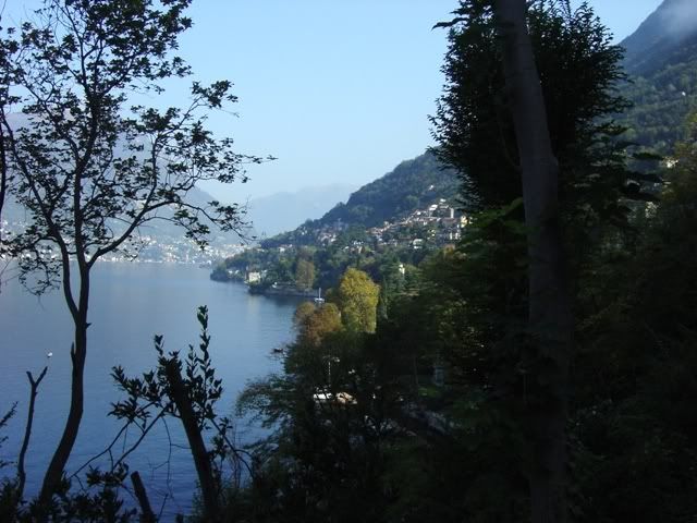
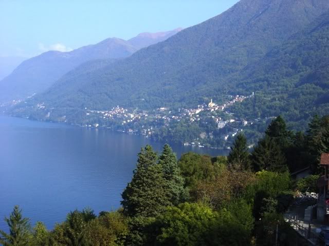
Lake Como is shaped like an upside down Y with the idyllic town of Bellagio at the tip of a peninsula where the Y comes together. I arrived on a Sunday afternoon and Bellagio was bustling wth day trippers from Milan, including a wide assortment of bikers.
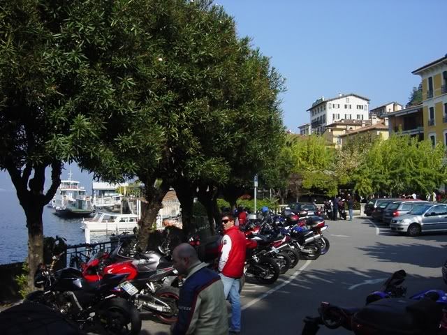
I also saw quite a noticeable contingent of Harley riders. Not the wannabe badasses seen in North America. These were the style with the wide beach bars. I call them George Clooney clones, as Mr. Clooney has been known to partake on the Lake Como roads on his Harley from his nearby villa.
An Aston Martin Vantage V-12 is like honey to a bear for Italians 🙂
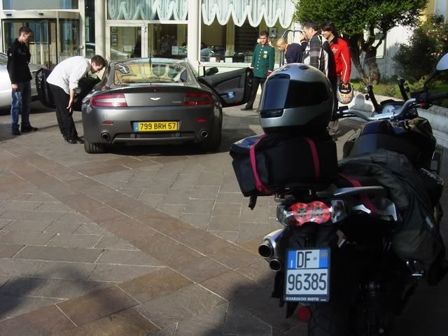
The following morning, I hop on one of the numerous ferries to Menaggio on the western shore. Looking back at Bellagio off the ferry stern, the good weather was still staying with me.
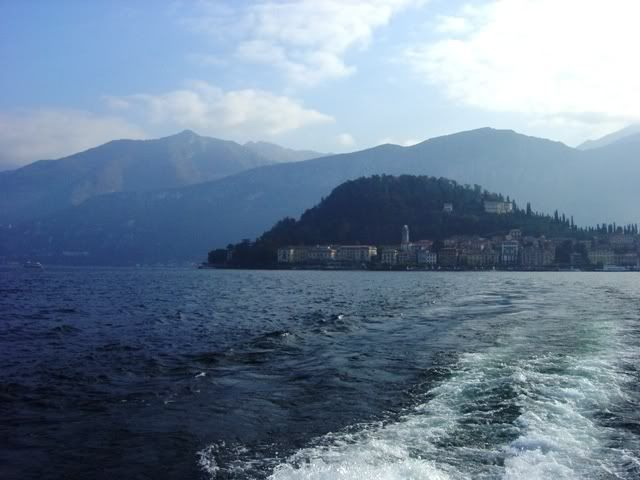
I follow the old road north along the lake.
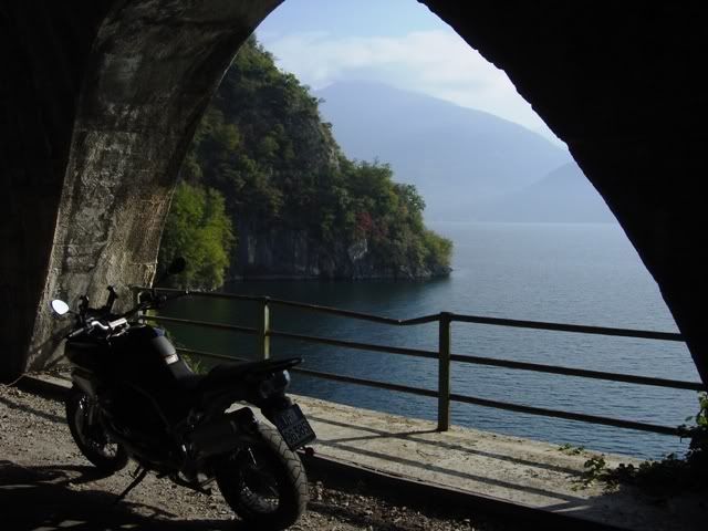
From Menaggio, I continue west to Lake Lugano. Italy shares Lake Lugano with Switzerland, however, wanting to avoid border crossing delays and snooty Swiss border guards, I decide to stay in Italy. I trace the southern shore of Lake Lugano before heading south into the hills between Lake Lugano & Lake Como.
October is a wonderful time to visit Italy. Most of the tourists have gone home, leaving the roads and the sites relatively traffic free. A soft, autumnal light caresses the landscape giving everything a portrait quality.
Climbing the road into the hills with Lake Lugano in the background.
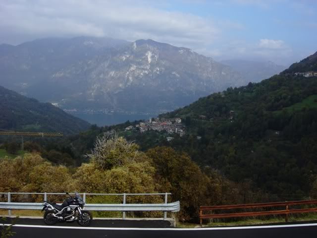
Tiny villages cling to mountainsides.
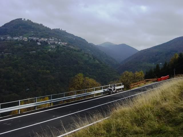
The further I got into the hills, the narrower, the road became. It was probably a good thing I was on the Stelvio, as the road became a veritable goat path.
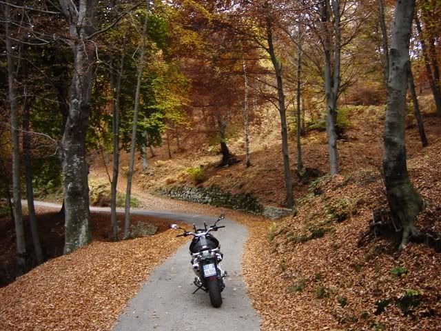
After about 20 kilometers of this, I finally made it over the ridgeline and began decending with Lake Como stretching out below me. Typical narrow streets encountered in the small mountain villages. Yes, trucks and busses pass this way.
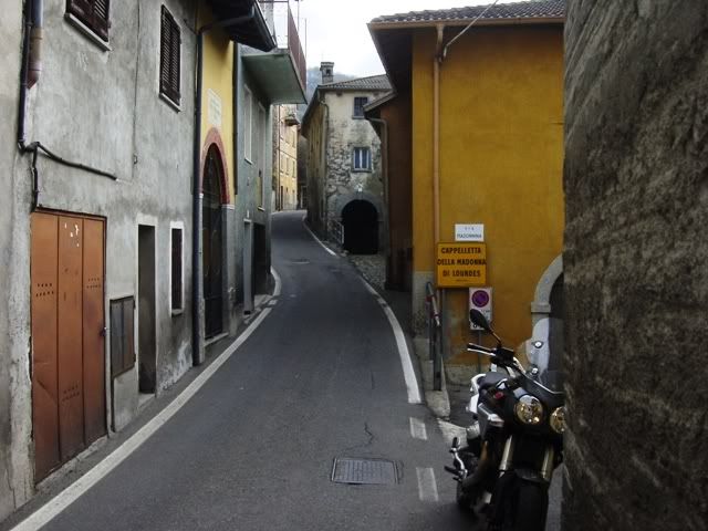
With the sun sinking in the west, I tried to capture an image of the steep Lake Como hillside near the town of Pigra. Apologies for the poor lighting.
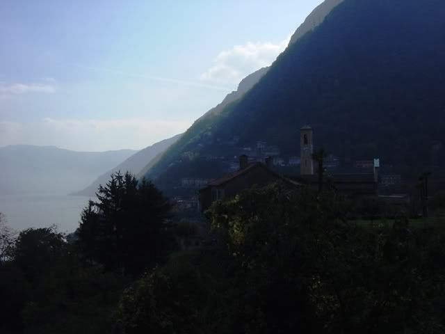
This was the best shot I could get of the road that clings to the lake shore near the town of Argegno.
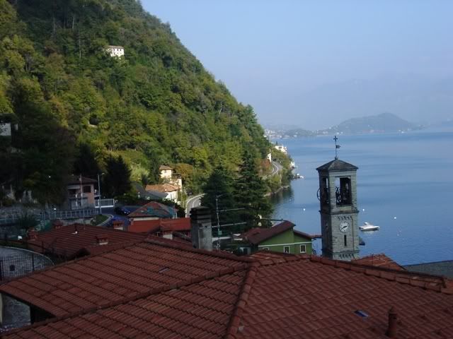
Making my way back to Menaggio, it’s late afternoon by the time I hop on a ferry back to my hotel in Bellagio. Approaching Bellagio on the ferry.
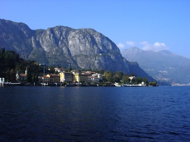
You’d be hardpressed to find a lovlier village than Bellagio…
Narrow shopping street in Bellagio.
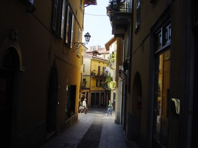
A park and a weir at the tip of the Bellagio peninsula looking west towards Menaggio.
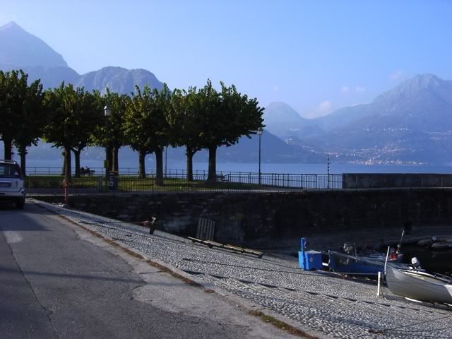
Another narrow alleyway opens up onto a view of the lake.

A quiet lakeside cafe
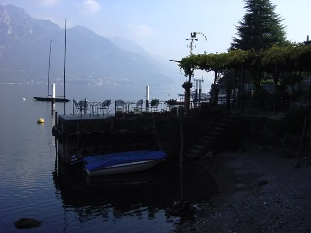
I head south towards Lecco at dusk to capture the image of the road carved from rock. Apologies for the poor lighting. The ever-suffering team orson photographer continues to whine that he can’t work with inferior equipment.
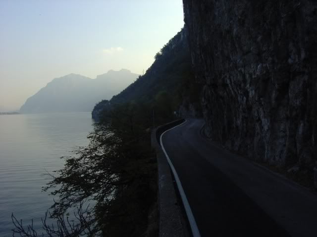
Another ferry approaches Bellagio. The ferry service is quite efficient as I never had to wait more than 15 minutes to catch one. The Italians love for speed is evident in the super cool hydrofoils that ply the lakes.
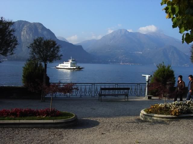
Disclaimer: team orson regrets having to post these images of rampant hedonism. It is hoped that by publishing these images, we can better understand the mindset of the hedonist.
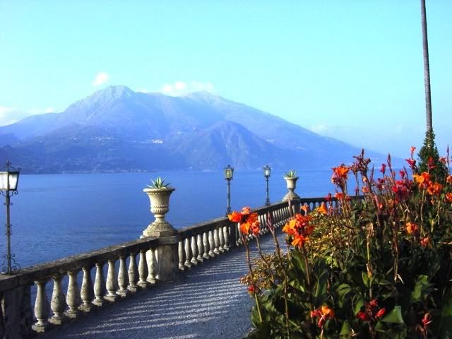
Sunset over Lake Como from the hotel balcony.
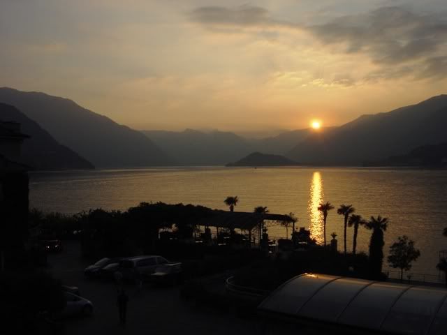
Watching the news, it is evident that an imminent cold front is approaching from northern Europe and bringing rain with it. team orson is forced to make an executive decision and drop down south to a defensive line along the Ligurian coast. The next morning still has blue skies, so we make time for a quick dash eastward via Varese, skirting Lake Varese to the Lake Maggiore ferry crossing at Laveno.
Crossing Lake Maggiore looking towards Verbania on the opposite shore.
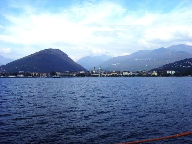
Staying ahead of the cold front, we follow the western shore of the lake heading southwards to Arona, before jumping onto la autostrada for a quick 3 hour dash to the Ligurian coast.
The Isola Borromee are a trio of islands that have ornate gardens and palaces built by the Borromee family since the 1650s.
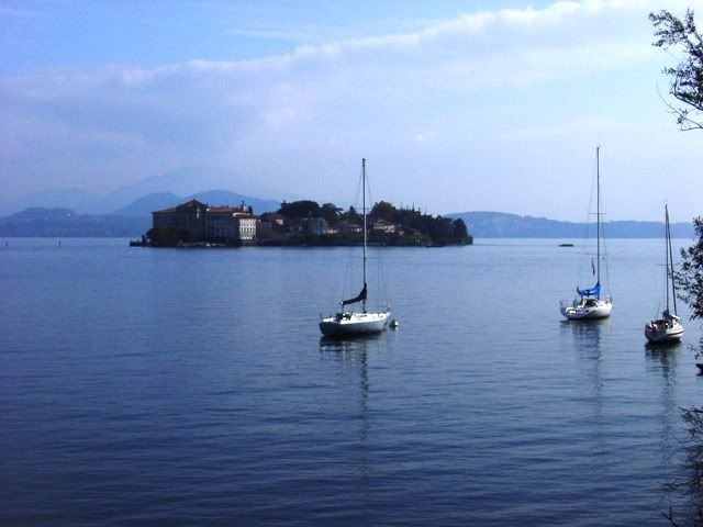
Regarding the Lake District as a motorcycling destination, in all honesty, the roads aren’t conducive to sport riding. The roads are very twisty with lots of traffic and few places to pass, even for a motorcycle. There are few roads inland from the lakes, as the mountain terrain is so steep. Mr. Clooney’s idea of cruising around on a Harley make more sense. If you can’t go fast, you may as well go slow and enjoy the lush views.
Approaching Genoa on the coast, I find myself tiring of the autostrada and beat a quick exit for a road following the coastline in the hills above Genoa. It turns out to be a fortuitous decision as the road turns out to be a freshly paved supermotard track. Unfortunately it’s a track that contains four-wheeled competitors so care must be taken on blind curves 🙂
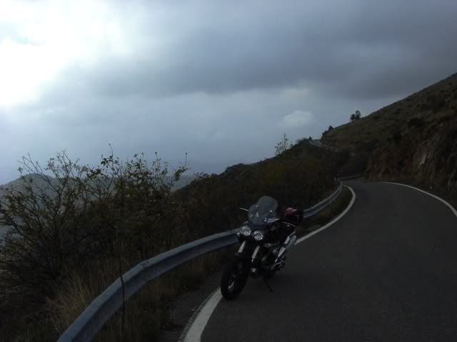
I have to say…Gawd, I love Italian riding. Motorcycles can get away with anything short of murder and cops just look the other way 🙂 You pass where you want, when you want and nobody honks at you. Solid white lines are meaningless. There were times when I would fall back into American riding, trundling along behind slower traffic, only to be buzzed by a sweet young thing on her moped.
I’m old enough now where my manhood isn’t threatened by such things. In one town a young thang zipped by me, while waving to a friend she saw. At least she wasn’t texting and waving. I stayed behind her on the narrow road to Portofino. Coming around one corner, we met a bus that took up most of the road, leaving a three foot gap between the bus and a wall of granite. Miss moped didn’t bat an eyelash, kept the throttle pinned and shot the gap between the bus and the wall. I stayed in her mirrors just to preserve my masculinity 🙂
Approaching the coast overlooking the town of Santa Margherita.
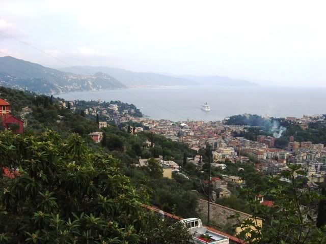
I decide to head for the quaint, if touristy village of Portofino and find a hotel that can make a martini. I strike paydirt, scoring a nice hotel near the mouth of the harbor.
The road leading to Portofino.

Last time I visited Portofino was in May of 2002 and I had gotten a bad vibe from the place from the rampant tourism. In October, it was a different story. With the throngs of tourists gone, you could almost squint and imagine what a lovely place it once was.
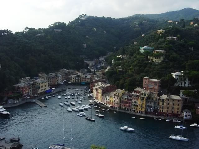
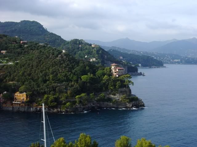
My plan to escape the rain had worked, as I had awoken to overcast skies, but no rain. After the funfilled supermotard track of the previous day, I decided to head up into the Ligurian hills and explore. I was finally encountering some motorbike worthy roads.
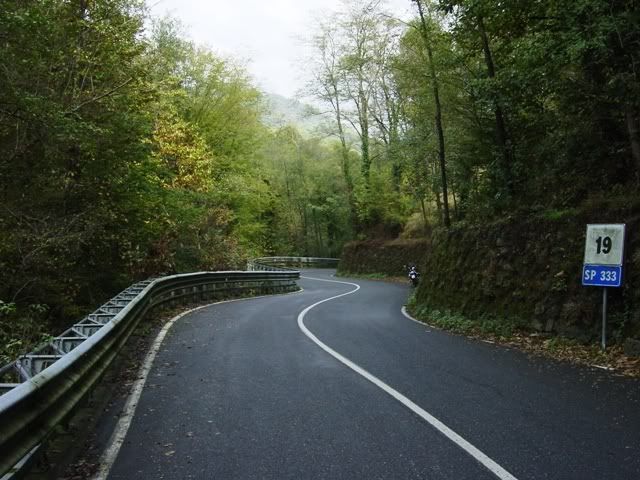
I came away very impressed with the hills around Genoa. I must make it a point to explore this region with more thoroughness 🙂
The final day on the road dawned with cloudy skies yet again, but the clouds had yet to unleash their damp revenge. After a leisurely breakfast with one last dossage of Italian cappuccinos, I head towards Parma across the autumn-hued Appenine range.
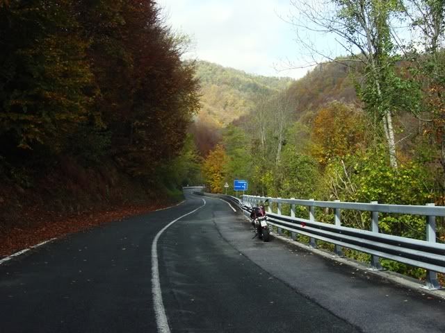
Trip route:
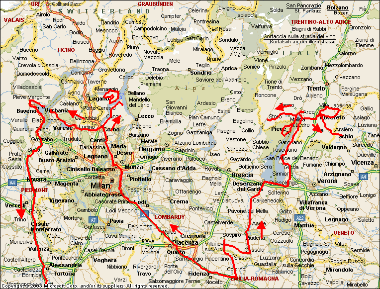
[IMG]http://i19.photobucket.com/albums/b173/Orsoni/image_map-7.gif[/IMG]
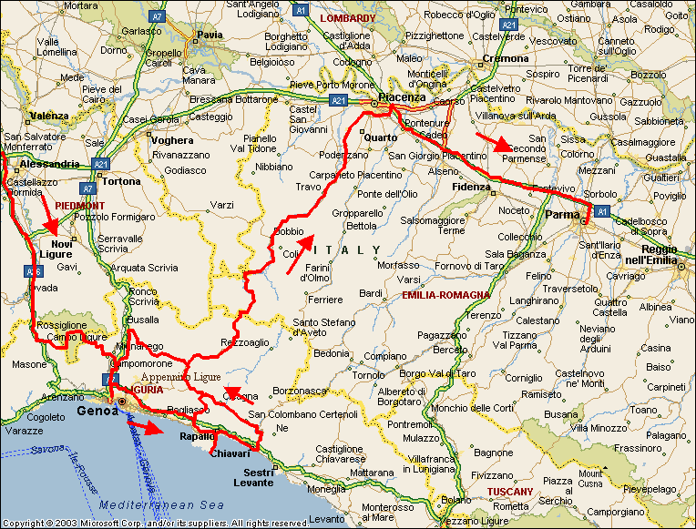
Mileage: uhmmm…I lost track. Maybe close to 2000 km in 8 days.
Carabinieri encounters: 1
Puckers: 1 (sand in curve)
Bee stings: 0
