Being George Orwell
Based on the film Being John Malkovich
In the aftermath of the Second World War, author George Orwell secluded himself on the bleak, outpost of Jura in the Inner Hebrides off the western coast of Scotland. It was here in the splendid isolation of the western isles that he wrote his opus, 1984. This is a journey to retrace his steps.
I departed from Nottingham in the East Midlands, traveling north through the Yorkshire Dales. If you’ve seen my previous trip reports, you know that the Yorkshire Dales are a bucolic setting worthy of being a destination in itself. It was on the narrow roads of West Yorkshire where TT champion David Jefferies honed his craft. Yorkshire is also home to the Lampkin motorcycle trials dynasty and it is not unusual to spot a number of trials bikes using public roads to link their trials areas. By chance, I come upon the The Yorke Arms hotel in a tiny village in the Nidderdale Valley that featured a Michelin starred restaurant. Sometimes I just get lucky.
The second day would be a short jaunt to the English Lake District, where I procured a room overlooking Lake Windermere

I spent the following day touring the Lake District passes in splendid October sunshine


After an overnight stay near Glasgow, I head north along the scenic Loch Lomond with the splendid weather still holding firm

A left turn at Tarbert takes me on the A85 along the Loch Fyne

I reach the ferry port of Kennacraig at midday, and by some miracle, the ferry to Islay is loading. It’s as if it were meant to be. After about a 3 hour sail, we reach Port Askaig on Islay. I ride across the island to Bowmore where I secure a room right next to the Bowmore Distillery. The next morning, I catch the small ferry across the Sound of Islay to the Isle of Jura

Tourism is light at this time of year. I’m the only vehicle making the crossing. I guess the adventure riders went elsewhere

My only link to civilization disappears over the horizon (possible embellishment)

Looking across the Sound of Islay towards Islay

The only road on the island heads up the east coast from the ferry port

A farm house with a million dollar view across the Sound of Islay

Looking southwards

The splendid isolation and wild beauty of Jura, virtually unchanged in the sixty some years since Orwell travelled this same road

Orwell spent approximately three years writing 1984 in between jaunts with his son, hiking and exploring the island

Clusters of farm houses dot the coast

As you continue northwards, the road begins to deteriorate

An unexpected patch of forest and pasture
 [/IMG][/URL]
Before the scenery opens up once more

I spotted numerous stags in the grasslands who exhibited no fear of human contact

Close up

Four miles short of Orwell’s farmhouse in Barnhill, the ride comes to an abrupt end

Curses!

Nothing left to do but turn around and head south on the same single track

An old barn overlooks the coast, the Scottish mainland in the distance

Although Orwell’s writing thrived on the island, his health took a turn for the worse. In 1947 he was diagnosed with TB. At the time, there was no cure for the disease. He managed to finish 1984 in November 1948, and died early in 1950.
The only hotel on the island is the Jura Hotel in the village of Craighouse, where I stop for a lunch of tomato pepper soup and fresh crab


After a late lunch, I catch the four o’clock ferry back to Islay. Back on Islay, I ride along the narrow sound between Islay and Jura.
Looking across the sound to the Paps of Jura

A quick stop for refreshment at the Bunnahabhain Distillery

Another view across the Sound of Islay towards Jura. The natural light at these northern latitudes can sometimes provide some spectacular displays, especially when rain showers simultaneously compete alongside bright sunshine to produce some mesmerizing lighting effects which in turn compete with the beauty of the natural surroundings. Something of a reward for being out in inclement weather

Islay lacks a bit of the rugged isolation of Jura, but has its own special charm

Two friends along Loch Indall in southwestern Islay

The village of Portnahaven with the Orsay Lighthouse in the distance

Hairy Scottish cattle give me the once over

The 7 o’clock ferry was the only available crossing back to the mainland. UGH!

Watching the sunrise over Jura from aboard the ferry

This description of an Islay malt made laugh. I had never seen spirits described in military terms

After reaching the mainland, I take a short jaunt across the Kintyre Peninsula and catch another ferry to the Isle of Arran. The weather began to take a turn for the worse and I was holed up for two days waiting out the rain. Fortunately, I stayed in a comfortable country home with an excellent restaurant. Eventually, the rain tapered off, and I caught yet another ferry across the Firth of Clyde to the town of Ardrossan on the mainland.
Looking back at Arran from the ferry

After 5 days in Scotland, I head south back into England, where I make my way to visit an old friend in Shropshire. The next day would be a short hop across the Peak District back to Nottingham.
I stopped at the famous Cat & Fiddle Pub. As it is a sunny Sunday afternoon, the place is hopping with bikes

Not just bikes, but even some Lotuses (Loti?)

Even the Smart cars were out in force, cheekily making three parking spaces out of two

About an hour before reaching Nottingham, I pass thru the town of Matlock Bath, the East Midland’s answer to L.A.’s Rock Store. The town is bursting at the seams with hundreds of bikers enjoying the sunny Sunday afternoon. Almost looks like the main drag of Sturgis

Trip Stats:
Distance- +/- 1300 miles
Travel days- 9
Rest days- 3
Police sightings- 0
Deer sightings- 3
Bee stings- 0
Route maps:
Scotland leg

England leg

Côte d’Azur & Les Alpes-Maritimes
Team orson embarks on a quickie, one-week venture across the border to the motorcycling playground that is the south of France.
Departing from team orson’s world headquarters in Parma, we stick to the backroads as we make our way across the Apennine mountains to the coast. The early fall temperatures combined with the altitude serve to feed the mighty, mighty goose with a horsepower boost in the form of cool, mountain air. We reach the coast by late afternoon and get a hotel room near Portofino. I didn’t take any pictures, so I’ll cheat and use a picture from a previous trip.

In a bid to save time, the next day’s route will be a blast up the Ligurian coast along the autostrada, the same stretch used by Richard Hammond to race James May in a cigarette boat. The road features dozens and dozens of tunnels cutting thru the mountains that line the coast. I can’t even begin to imagine how long the trip must have taken before the autostrada was constructed.
Just after crossing the French border, we leave the highway and head up into the hills in search of twisties. As you approach Monaco, you begin to notice an increase in the amount of auto exotica. In a matter of a few hours, I must have seen four or five Bentleys and a couple of Ferraris. Porsches and Mercedes seemed downright pedestrian in these environs. This is the closest they will allow you to get to Monaco on a Guzzi.

With the purchase of an iPad, this would be the first trip where team orson traveled with any electronic devices besides a digital camera. Perhaps lured by the flashing lights and whirring noises of this strange device, the team orson navigator threw caution to the wind and drunkenly decided to make a hotel reservation with the contraption. His reckless action would very soon come back to haunt team orson.
A tip that the ride along the coast to Cap d’Antibes was enjoyable proved to be wrong, as we encountered lots of traffic and very little scenery. With the skies beginning to darken forbiddingly, the decision was made to turn inland at Cannes and hit La Route Napoleon. A few years ago, BIKE magazine declared La Route Napoleon to be the “Best road in Europe.” While that would be a subjective opinion for sure, in my opinion they weren’t far off the mark.

Fast and flowing, La Route Napoleon may be short on photographic charms, but is top shelf stuff for releasing your inner Mike Hailwood 😀 For about sixty blissful kilometers, there are almost no towns or side roads to slow your progress. The mostly open nature of the terrain means that four-wheeled chicanes are easily dispatched.

Approaching Castellane, the dark skies begin to release their moisture with a vengeance. In the past, team orson would have retired to the nearest warm and dry hotel room. But now armed with a newfangled i-Pad, team orson felt compelled to continue onto their reserved hotel room, some 100 kilometers distant. Harsh words were exchanged between the team orson photographer and navigator, as the benefits of modern technology were called into question.
The last fifty kilometers were a slow, wet slog along the road that hugs the northern edge of the Canyon du Verdun. Although it was raining heavily, brief glimpses of its grandeur occasionally revealed themselves. Thankfully, the rain began to taper off later in the afternoon, allowing for a few photographs thru the mist.


The following morning dawned with an improved weather forecast, and I spent the day meandering back along the northern edge of the canyon before returning along the southern edge.


Coming into a small village, I saw a large group of about 20 motorcycles leaving a gas station. My initial reaction was, “Oh great. I’m going to have to work my way thru the slow pokes.” Not to worry though. This was France and these weren’t a Harley parade. Within a minute, the group had blasted away. France has a fantastic moto-culture. Despite having roughly the same population as the UK, they have twice as many registered motorcycles.


I stayed the night in the picturesque town of Moustieres-Sainte-Marie on the western edge of the canyon. The hotel’s restaurant was fantastic and I left thoroughly bloated after a six-course meal. Even the dessert had a dessert.
Moustieres-Sainte-Marie in the morning light.

We headed north towards les Alpes Maritimes. The south of France is chock full of lazily, twisting two-lane roads.

I was amazed at how little traffic there was on these roads. I stopped to take this picture, and not a single car came by during the entire five minutes that I was stopped.

The mountains begin to grow as you approach Barcelonnette.


At Jausiers, I turn south and head up la Col de la Bonette. The road signs claim that it is the highest paved road in Europe, but Wikipedia disputes this, claiming that it is only the third highest road. As I begin the climb, the skies begin to darken once more. As I reach the summit and begin the descent, I catch a glimpse of the rain waiting for me in the valley below.

Fortunately, by the time I make it to the valley floor, the rain has dissipated and I scamper off to find a hotel room. I awaken the next morning to a blazingly blue sky and turn back north. I’m not sure if this is a castle of maybe a monastery high above the valley floor.

The D-2202 between Annot and Guillaumes…oh my, my :drool: Such a wonderful stretch of tarmac is the stuff of dreams. the pictures can’t begin to do it any justice. I rate the French highway system among the best, if not the best in the world. Most of the main roads a paved with smooth, well marked asphalt.

A close up of the church in the distance.

Looking back at the D-2202 show it snaking its way alongside a riverbed.

After Guillaumes, the road narrows as it begins to climb la Col de la Cayolle. this climb seemed to go on forever.

About 10 kilometers short of Barcelonnette, I came upon this road works. D’oh! Merde Alors! I would have to backtrack almost an hour if I couldn’t get by.

Using my high school French, I found out that they would open the road in one hour, so i decided to cool my heels and wait.
After topping up the gas tank in Barcelonnette, I turned south once more and headed up la Col de Maure. While the fall colors aren’t as spectacular as New England, there were a few spots of vibrant color.

After a long day slaying mountain passes, the mighty, mighty goose stops to absorb some of the scenery.

The D-6202 is another wonderfully enjoyable road on a motorbike, fast and flowing, with hardly any traffic or pesky switchbacks to slow your pace. This trip to Provence has only served to solidify my belief that, the south of France has some of the best motorcycling roads anywhere on the planet. Wales & Scotland come close, but get knocked down a notch because of their infamously, soggy weather. Northern California and the south of France are the top of the pops in my book.
Once again I awaken to bright, blue skies, but alas, my time is running short. I point the goose back towards Italy for the homeward leg. I take a small detour off the autostrada in Italy to the bridge at Dolceacqua that was painted by Claude Monet.

Further up the road is the picturesque town of Apricale, perched precariously on a hilltop.

Once again, I use the autostrade to blast down the Ligurian coast. Looking back north along the coastline.

I spend the last night in Portofino. The view of Portofino harbor from the hotel room balcony.

In an effort to blend in with the local populace, team orson purchased some spiffy, Italian loafers. Whereas team orson was treated as a furriner before, now people mistake us for locals and stop to ask us for directions.

The next morning, we begin our final leg across the Appenines back to Parma. The scenic road leaving Portofino.

I stop for lunch in a small town and take a final photograph of possibly the most beautiful sport touring bike on the planet. Ten years on and the bike never missed a beat, still going strong after 80,000 km.

Route Map:

Trip stats:
Distance- 2,000 kilometers
Travel days- 8
Rest days- 0
Carabinieri sightings- 3
Gendarmerie sightings- 0
Deer sightings- 0
Bee stings- 2
2012 Southern Italy
My 2012 vacation would mark the tenth anniversary since the inception of team orson. One would think that a grand tour would be called for to celebrate the occassion however, as I left Saudi Arabia for team orson’s palatial world headquarters, I didn’t have a clue where I wuz going. Befuddled and confused, I packed maps for both France (north) or Italy (south).
A late start meant that it was 4 P.M. before I left Parma and headed over the Appenines via the Passo della Cisa towards the coast, still without a clue which direction I wuz headed. I stopped for the night in Portovenere, exhausted after a little over 100 km. Portovenere isn’t as famous as its Cinque Terre neighbors or as posh as Portofino, but has a pleasant enough waterfront.

I usually sleep 6 hours a night, but that first night I slept 10 hours! Holy kwap! Wuz I becoming a lightweight in my old age? Watching the TV news, the decision on which direction to go was made by the weather report. Rain in France while southern Italy basked under sunny skies.
As I had ridden thru the Apuan Alps in northern Tuscany on previous trips, I headed south along the coast towards the Marrema region of southern Tuscany, off the beaten tourist trail, but gradually becoming discovered. After only 6 hours, I was already toast, and decided to stop at a very chi-chi resort on the Monte Argentario peninsula. This place was so quiet and relaxing that team orson made an uncharacteristic decision to stay another night.
The next day, we sallied forth and rode around the peninsula on a blazingly hot spring day. The road was scenic, but a bit too congested for serious shredding.

I circumnavigated the peninsula in about two hours and was back at my hotel just after lunch. The high temperatures and the lure of a refreshing swim was too hard to resist, and I parked the bike for the day. The leg that had I injured in South Africa was giving me a lot of pain that I didn’t have when I rode last year. Swinging my leg on and off the bike was accompanied by excruciating pain. Once I was under way, there was no pain, but stopping for photos now was an ordeal. I developed a system where I grabbed my stitch by the ankle, and slowly lifted my leg on & off the bike. I’m sure people watching this thought I wuz nuts.
A view of the cement pond that lured team orson off the roads. Wheeee dawgie! team orson’s gonna hafta buy something other than t-shirts to blend in with this crowd.

Sunrise over the Monte Argentario peninsula.

After three days of whiling away the hours with the glitterati under crystal blue skies, team orson felt refreshed enough to finally hit the road. I continued south along the coast until turning inland at Civitavecchia.
A rugged looking hill town somewhere north of Rome.

After skirting around Rome and its heavy traffic, I continued making my way south along the spine of the Appenine mountains through the Parco Nazionale d’Abruzzo.

Even this far south, there was still a dusting of snow covering the peaks.

The following day, I reached the scenic Amalfi Coast, and found another, all too comfortable hotel. Team orson was rapidly becoming spoiled.
A view of the town of Amalfi from the hotel balcony.

The Amalfi Coast road has acquired a fearsome reputation as one of the scariest roads in Europe, although it’s not too bad on a motorbike. I think most of the reputation comes from tourists being driven by locals. It’s always scarier when someone else is driving. A good definition of Hell might be having to drive a bus on that road on a daily basis.
Heading west on the Amalfi Road

Looking back east

A secluded grotto viewed from the road

Heading back towards the hotel

Southern Italy is known for limoncello, and this time of year, lemons are bursting off the trees. Two glasses of this stuff will put you down for the count. That might explain the crooked horizon in the picture

Another view of Amalfi from the hotel.

After leaving the Amalfi coast, I continued south into the region of Campania. I stopped briefly to view the impressive Greek ruins in Paestum.

Venturing deeper into Campania, the terrain began to resemble the California coast. I had no idea of what lie ahead of me.


At Praia a Mare, the mountains rise straight from the sea, as the road clings to the cliffs in a perfect mirror image of California’s Big Sur.


In all my travels and all my reading, I had never heard of this stretch of road. Discovering a hidden gem of a road is worth massive bonus points.


The spectacular stretch of road ended all too quickly after only 30 kilometers, much the same as the Pacific Coast Highway does as it approaches L.A. It marked a fine ending to my longest day in the saddle, a good eight hours.
The next day, I travel inland across a small mountain pass. I had the road blissfully to myself, seeing only a couple of other cars before lunch time.

The farther south you get, the fewer the hordes of German & Dutch bikers who plague the Alps like locusts.

After crossing the mountains, I reach the southern coast of Italy, the sole on the boot if you will. It’s too early in the season for most of the coastal hotels to open and I have to ride all the way to the port city of Taranto before I find a hotel room.
From Taranto, I turn around and start heading north. The terrain of the Basilicata region is a pleasant vista of rolling hills which provide mostly straight, but throwing in enough high speed sweepers to keep things entertaining. Stopping for lunch in Italy is a bit of a conundrum. Most Italians eat lunch at about 1:30 before going home for a mid-afternoon break. If you don’t find a restaurant by 2:30, you’re out of luck as all the restaurants close and won’t open until 7 or 8 that night. This is the way they’ve done it for centuries and they’re not about to change Coming from the land of 24 hour breakfasts, this is hard to adjust to. It’s a bit maddening at times, but when it comes down to it, I’m glad Italians preserve their way of doing things. I still haven’t been bold enough to order wine at lunch, as nearly all the locals do.
By late afternoon I enter Puglia and reconnect with the coastline at the Manfredonia. The Parco Nazionale del Gargano takes up the bump protruding from the back of the Italian boot.
La costa Pugliense


The towns in this region are whitewashed giving you the impression that you might be in Andalusia or Morocco.

From Puglia, I blast north along the autostrada before heading inland in Abruzzo, just south of Pescara. I was mighty impressed by the size of the mountains in Abruzzo. Not quite the Alps, but beautiful nevertheless.
Near the Umbrian town of Norcia, in the Parco Nazionale dei Monte Sibilini, lies the vast open plain known as Piano Grande.

In the springtime, the plain is covered with yellow rapeseed and red poppies. Unfortunately, there were no poppies when I rode thru, but lots of rapeseed. The village of Castelluccio in the distance is the highest settlement in the Appenines at 1,452 meters.

The mighty, mighty Goose waits impatiently as the team orson photographer dawdles

A small castle stands sentry over a mountain pass

From Norcia, I travel the breadth of Umbria in one day to reach the Autodromo dell’Umbria near Perugia, where the following day, I get to attend a classic bike race.
Gianfranco Guareschi, champion to Guzzisti faithful everywhere for his slaying of the NCR Ducati at the 2007 Daytona was in attendance on a V7 Cafe Sport. A loyal fan base keeps applying to have him anointed a saint, but the Vatican insists on raising the technicality of people being dead before attaining sainthood.
Here, team Guareschi fends off rabid fans. Gianfranco in the grey shirt with Papa Guareschi in red.

There were a lotta neat bikes at the meet. These Kawasaki KR250s, ruled the world championships in the 1980s. This was the first time I’d seen one up close, and couldn’t believe how small they are.

FOR SALE- Franco Uncini’s 1982 world championship winning RG500 Suzuki

Not for sale, a Benelli 500-4

The riders take the grid, with Gianfranco having qualified fourth in a field comprised of about 80% Guzzis and 20% Ducatis. A Ducati 996 was on pole.

The flag dropped and Guareschi entered the first turn in fourth place. By the exit of the first turn, he was in front with about a 50 foot lead. The Ducati’s horsepower closed the gap on the back straight, but once they reached the twisties, Guareschi wuz gone, leading every lap.
After the races, I headed back into Tuscany on the final leg of my journey. This was the first time I had been to Tuscany during the springtime, and I must say I wuz impressed. everything was green with a vast carpet of red poppies. The roads don’t fail to impress either.
Tuscan hill towns

picture post card roads


Monte Amiata, the highest peak in southern Tuscany watches over the Val d’Orcia

There haven’t been many pictures of the Goose in this report due to the pain in my leg while mounting and dismounting, so I thought I better take one last shot in front of a carpet of poppies.

I stopped for the final night at the same little hotel I stayed in two years ago with a lovely view of the town of Bagni di Lucca. This time I came prepared with a bottle of Tuscany’s finest

The last day, I crossed the Appenines one last time via the Passo Abetone. There’s a small church up in the hills, but it’s hard to see in the picture.

I arrived in Parma at around 3 P.M. then unpacked the bike and bade my farewells. After 10 years, the mighty, mighty Guzzi had performed flawlessly, devouring every road put before it. Che macchina!
Route maps:
Central loop

Southern loop

Trip stats:
Distance- 4,100 kilometers
Travel days- 21
Rest days-5 😮
Carabinieri encounters- 0
Deer sightings- 1
Bee stings- 0
National Parks ridden- 7
Italy’s Piedmont Region
Just a quickie one week trip report in Northern Italy for the Guzzi gathering and a trip to the Piedmont Region…
team orson arrived in Italy just in time for Moto Guzzi’s 90th anniversary party in Mandello del Lario on the shores of idyllic Lake Como. From Parma to the Italian Lake District is but a mere three hour jaunt via la autostrada. Usually, seeing another Guzzi on the road is a rare event however, as I approached Lake Como almost all the bikes seen on the road were other Guzzis, which was rather a strange experience.
The only hotel I could find was across the lake in Bellagio, but this really wasn’t a problem as Lake Como ferries run regular routes across the lake. After checking in to the hotel, I boarded the ferry for the 15 minute ride across the lake to Varenna.
Taking in the views and the cool lake breezes on the crossing

Nuthin but Guzzis on the ferry. I met some Dutch riders who had ridden from Holland to Mandello in one day.

Approaching ferry port of Varenna on the eastern shore of Lake Como.

From Varenna to Mandello was a quick 15 minute hop. Many businesses along the road to Mandello had Guzzi banners hung out to welcome the hordes. I arrived late Friday afternoon and the place was already brimming with Guzzisti. As I walked around taking in the sights, Guzzisti from all over Europe continued to roll into town.

Sport touring as it once was

By Saturday morning, the place was really filling up

Italian fast food

Somehow, a Benelli managed to infiltrate the event

After two days spent ogling the bikes, it was time to move on. Leaving Lake Como, an early snowfall had dusted the alpine foothills

I headed west along the base of the Alps. The roads on the southern side of the lakes are clogged with traffic and it’s not until you get past the western most lake, Lake Orta, that I begin to get a respite.

I spot a road on the map that heads up into the mountains before dead ending at the ski resort of Alagna Valsesia. I’m always intrigued by those end-of-the-road places and decided to make that my stop for the night. The town seems a veritable ghost town with most hotels closed for the season, but I luck out and manage to find a hotel that has remained open.
The following morning dawns with clear blue skies providing a clear view of the largest mountain in the area, La Monte Rosa.

Heading back down into the lowlands of the Po Valley

There’s a rather abrupt transition from the mountains to the plains

A small village with the snow peaked Alps in the distance

As I continue southwards, the terrain begins to turn to undulating hills as I reach the Langhe area of Piedmont.

The Lonely Planet refers to Piedmont as ‘Tuscany without the tourists’, as its hills lined with vineyards bears a resemblance to its southern counterpart.

The area is famous for its wines as well as its white truffles. I stay at the Hotel Castello di Sinio run by an American woman with a super friendly staff and a great ambiance. I manage to arrive right during the white truffle season and get an opportunity to sample truffles in the local cuisine. The Piedmont Region has become known as the seat of the Slow Food movement in Italy. I’ve stated before that it’s almost impossible to get a bad meal in Italy.


Piedmont has an undiscovered air about it, as the vast hordes of tourists and tourist buses seen in Tuscany are absent, making you feel as if you have the whole place to yourself.


The area around Asti and Alba is crisscrossed with roads snaking their way through farms and vineyards. As it was harvest time, I often encountered farm tractors on the road but they moved slowly so it was fairly easy to pass them.


After two days in Piedmont, it was time to make my way back to home base in Parma. I think that one of the reasons there are so few visitors to the Langhe area is that it is difficult to traverse from east to west. Most of the main roads run perpendicular to the coast, leaving paved goat trails running east to west. This might be why most people stay on the autostrada and continue on down to Tuscany.
Still, I was determined not to take the autostrada to Parma and forged ahead, stringing together a series of backroads. Just south of Tortona, I decided to stop for the night. I continued forging my way eastward by sticking to the backroads. The terrain was still hilly, but less picturesque than the Langhe, so I didn’t stop for any pictures. Sometimes I took a wrong fork in the road and would end up on a remote goat trail before my instincts kicked in and told me that this didn’t seem like a major artery.
Finally, at around two in the afternoon, I reached the town of Bardi with a main highway leading to Parma. The road from Bardi to Parma is a stellar motorcycling road with fast, sweeping curves seemingly custom made for the Goose. The Guzzi’s massive torque, like an avalanche sweeping away everything before it, easily overtook any cars in its path. Before long, we were back in Parma bringing a great week of riding to an end.
Trip statistics:
Riding Days: 7
Rest Days: 1
Mileage: 2500 km
Police encounters: 0
Bee stings: 0
Route Map:

Western Scotland & Northern Ireland
A plan was hatched to do Scotland properly. I had been once before in 2003 when the Guzzi was in a friend’s barn in Shropshire. At that time, I only had a week and had only made it as far as the Isle of Skye before time ran out and I had to turn around and head south. Still, what I had seen was enough to whet my appetite for more.
A P.M. was fired off to a friend in Scotland, asking for a few route tips. Instead, he went far above the call of duty and provided Google maps and plenty of suggestions on where to stay. He even went as far as to arrange an oil change in Aberdeen for my Thruxton. I hafta doff my chapeau to him. I owe him the equivalent in return. Unfortunately, as I headed out the door to the airport, I left his maps and printed advice on the kitchen counter. D’oh!
After an overnight flight to the U.K., I arrived in Nottingham and loaded up the Thruxton. By 2 P.M., I was on the road and heading north along the A1. At Scotch Corner, I turned westward on the wonderful A864 across the Yorkshire Dales. It was at this point that the team orson photographer realized that he had forgotten the camera’s battery back in Nottingham. He tried to blame it on jet lag but, his actions were inexcusable
At around 6 P.M, it began to rain lightly (this would be a recurring theme) and decided on a nice inn near Hawes. The plan for the following day would be to make time on the M6 motorway in order to catch the final day of the 100th running of the legendary Scottish Six Days Trial held around Fort William. I got lost in Glasgow and ended up heading northeast instead of northwest. I finally realized my mistake when I reached Stirling but, it turned out to be a fortuitous mistake as, the A84 turned out to be a great ride. Ha! Let’s see yer GPS do that!
Back when I was but a wee lad, the Scottish Six Days Trial was a major motorcycling event, dutifully reported on by the U.S. bike rags along with the ISDT and the Motocross des Nations. Sadly, in this day of freestyle MX and stunt shows, the trial has lost it’s luster and like the Daytona 200, lives off its former glory. Still, I felt an urge to witness this unique event in which trials riders cover as much as 100 miles per day over 6 days.
From my hotel, I rode up towards Kinlochleven, not really sure what I was looking for. After riding through the town and seeing no signs of the event, I eventually came across many cars parked alongside the road. A short walk up a dirt road soon had me at one of the sections along a rocky creek bed. It was interesting to see how the different riders tackled the sections, from the apprehensive youngsters to the wiley gray beards. Although the skies threatened to rain, it stayed mostly dry.
I then rode a few more miles to reach the famous Pipeline Section. Since I didn’t have a camera. It’s difficult to convey how long and how steep it is. It’s so long, they separate it into four sections. It was amazing to watch the riders switch from unstoppable bulldozer mode to ballerina mode then back to bulldozer several times.
Later in the afternoon, I rode to Fort William for the awards ceremony and to walk around the pits. A couple of blasts from the past were there with the team Ossa truck as well as the newly reformed Greeves factory. I was hoping to score a 100th SSDT t-shirt but, they were sold out and I had to settle for a beanie.
The next day, I woke up to face of an ominous rainy weather forecast. I was to ride across the breadth of Scotland to meet up with my friend in Aberdeen on the east coast. Amazingly, I rode through bright sunshine all the way up until 2 P.M. when a brief shower finally lashed out at me. Upon reaching Aberdeen, directions from a friendly local soon had me my friend’s front door.
My friend lives in an amazing home, formerly a church. If you’ve ever watched a James Bond film where the protagonist is invited into Dr. No or Goldfinger’s lair, that’s what it was like. A vast open area with a couple Ducatis and a KTM motard overlooked by a huge stained glass window. I think having a Bond villain’s lair is everyone’s fantasy. Impressive!

Following his advice, we agreed to make the fishing port of Ullapool our base of operations on the west coast. We left Aberdeen the next morning headed towards, Edinburgh. As I was just following my friend rather than relying on a map, I had no idea where I was but, the sun was out and the traffic was light so, all was well in the world. The highlight of the day had to be the road on the north shore of Loch Ness. What a magnificent motorcycling road with fast, sweeping curves and lots of places to pass slower traffic.
Looking north from the south end of Loch Ness

After a drenching rain, we finally reached Ullapool just after 7 P.M. A fish and chips dinner from the local chippie, a hot shower, a wee dram of scotch and it was off to never never land to sleep the sleep of the dead.
Sunset over Ullapool

The next day we headed north, using the single track road that hugged the coast.
Heading towards Achiltibuie on the Coigach coast


Continuing northwards

Encountering two other bikers heading south

The coastline reminded me of Norway at times


Despite the threatening rain, we remained dry as we approached the north coast.

Near the north coast, the Highland terrain opened up and offered vast vistas


We reached Durness on the north coast at around 4 P.M. before deciding to return to Ullapool via the main highway.
Views heading south


Dropping down into Ullapool from the north

In Ullapool, we managed to find a shop that sold cheap digital cameras so, apologies if the pictures aren’t up to snuff. We returned to our friendly hosts at our bed & breakfast just outside Ullapool for a hot shower and a nice steak dinner. After a good night’s sleep, we headed south from Ullapool, again following the coast.


The Isle of Skye hoves into view off our starboard

Belach na Ba kind of surprised me. Being so close to the coast, I wasn’t prepared for something that resembled an Alpine pass.
My friend heading downhill on his Ducati

Loch Carron. Somehow, dark and moody seems to fit this location better than bright sunshine

By 5 P.M. we were still on the west coast and my friend had been hoping to make it to Aberdeen that night! At Locharron, we bade our farewells and went our separate ways, my friend back to Aberdeen while I headed back to Ullapool for one more night before catching my ferry to the Outer Hebrides.
Outer Hebrides
The following morning I woke up to more rain. I suited up and made the short ride into town to the ferry pier. Only three other bikes waiting to board. You must really want to go to get there.

By the time the ferry reached Stornoway on the Isle of Lewis at midday, the weather had improved. The rugged Isle of Lewis and Harris contain some of the oldest rock formations in Europe. While the scenery might be stark and bleak, I’ve always been attracted to these “edge of the world” type places.
Desolate isolation on the Isle of Lewis

The standing stones of Callanish whose meaning has been lost in the mists of time.

From Callanish, I turn south along the rugged western coast of Lewis


I continued south until grass started growing out of the asphalt. A sure sign I was getting near the end and would have to turn around

I should note that these aren’t ideal sport touring roads or even motorcycling roads at all but, if you have an itch for remote places, the Outer Hebrides definitely scratches that itch.
Pointing north

I rejoin the main highway and head to the southern part of the island known as Harris which is even more rugged than Lewis

In the town of Tarbert, I find a cozy bed & breakfast run by an elderly woman who reminds me of my mother. I’m struck by the friendliness and warmth of the Hebridean people.
The next morning, I continue south to catch another ferry, this time to the Isle of North Uist. I make a quick detour to the small island of Scalpay where I again reach the end of the road and am forced to turn around.


I’m surprised when the sun makes a rare appearance to reveal some pristine, sandy beaches on South Harris


I reach the ferry port at Leverburgh to find that I am the only motorcyclist waiting in line. You must really, really want to get somewhere to be the only motorcyclist.

The ferry ride to North Uist took about 50 minutes but, it was no simple crossing as the captain had to zig-zag his way amongst a veritable mine field of rocks and islets. He definitely earns his paycheck. Although not quite as rugged as Lewis & Harris, North Uist seems even less populated and remote


A lonely telephone box stands sentinel along a back road

North Uist is connected to the Isles of Benbecula and South Uist by a series of causeways. A local told me that during a bad, winter storm, a car and its occupants were swept off a causeway and out to sea by a rogue wave.
Another squall about to drench me blows in off the Atlantic. The wind was blowing the entire time I was on the Outer Hebrides. I can only imagine what the winter storms must be like

I made it as far south as the Isle of Eriskay off the southern end of South Uist before turning around and heading north. About 10 miles from my hotel, I was hit by yet another drenching squall. Suddenly, the Thruxton sputtered to a stop as if it had run out of fuel. Great! I was stranded in the middle of nowhere, with the rain pouring down. I peered into the gas tank and gave it a shake. I pushed the starter button again and, she fired right up! Hmmm. Maybe the carbs sucked in some rain or sumthin. I high tailed it to the hotel before she changed her mind again. That would be the only hiccup during the trip.
The next morning on the main road on North Uist (seriously, this is the main road), a herd of sheep blocks rush hour traffic. By the time they had been herded to their paddock, a four-car traffic jam had been created

I made my way to Lochmaddy where the MV Hebrides would take me on the 2 hour crossing to the Isle of Skye.

Once again, I was the only motorcycle on the boat. I didn’t see any motorcycles that looked like they were ridden by locals on the Hebrides. The few bikes I saw were obviously touring. With their roads and their weather, you’d have to be serious to be a regular motorcyclist on the Hebrides.
Once on Skye, the weather let lose with a vengeance. The forecast called for two solid days of rain so, I did what every perfeshunal dilettante does and found a nice hotel to hole up in and get some laundry done.

Eventually, the rain let up a bit but, not enuff to give me blue skies. Portree is the main town on Skye

The Cuillin Hills in the distance on the Isle of Skye

Ferry number 4 would take me from Skye back on to the mainland

Argyll
The Morvern Peninsula is an isolated place of wonderfully stark scenery

In the little town of Lochaline, I stumble upon the White House restaurant that serves locally sourced meals. It was here that I had one of the best meals of the trip. These unexpected gems that you happen upon by chance are part of the allure of travel for me.
Heading back north along Loch Linnhe with ever-present threatening skies

Ferry Number 5 takes me across Loch Linnhe

Once again heading south, I make a detour thru Glen Coe. This is one of those places, like Yosemite, whose beauty stands out even in inclement weather


I continue south through the port city of Oban which kind of reminds me of small version of San Francisco. A western port with a slightly seedy underbelly. I make it as far south as Lochgilphead before a bit of rain followed by a strong, cold wind makes me stop for the night.
The next morning I head south along the west coast of the Kintyre Peninsula on the A83. With a good view of the ocean and a salty sea air, it stirs memories of my days in Northern California


At Campbeltown, I fill up with fuel and turn north following the single track lane up the eastern side of the peninsula

At Claonaig, I await ferry number 6 to take me across as the Isle of Arran looms in the distance


Impressive mountains of Arran

I head east across the middle of the island and get a view of the Firth of Clyde with the Scottish mainland in the distance

A one hour ferry ride takes me back to the mainland at Androssan where I make a quick hop south to get a hotel in Troon in preparation for tomorrow’s ferry to Northern Ireland.
I wake up bright and early on Friday and make my way to the ferry terminal. This is the day before the North West 200 race in Northern Ireland and this time, I surely won’t be the only motorcyclist on the boat. I’m one of the first bikes in line and get to watch the bikes accumulate

I soon begin to notice a trend. Most of the race fans are in their 50s or close to their 50s. I see a few riders who might be in their mid-30s and none in their twenties. I’m wondering if high insurance rates are the cause of the lack of youth or maybe it coincides with the birth of the internet some twenty years ago.
Soon the signal is given and the horde of bikes is herded on board. I figure there must be between 200 and 300 motorcycles

Northern Ireland
I arrive in the port of Larne at about midday and am met by fellow Guzzisti, BelfastGuzzi from the V11lemans web site and his friend, both on Guzzis, who have kindly offered to provide me a tour of the northern coast

The North Antrim coast road doesn’t seem to get much press but, it’s a fantastic ride. Much too tight and lined with stone walls for any kind of serious sport riding but, the scenery more than makes up for that

BelfastGuzzi takes me on a road less traveled that hugs the coast and offers spectacular views of Torr Head

The picture doesn’t adequately convey the steepness of the single track lane descending the hillside


Unfortunately, race day dawns with a windy rain. I walk from my hotel down to the grassy viewing area at the Metropole and by the time I find a place to sit, the rain is diminishing

By the 11:00 starting time of the North West 200 race, the rain has stopped although the track remains wet. The 600 Supersport class leads off and Aussie Cameron Donald engages local lad Alastair Seeley in a ding-dong back and forth battle. Donald’s Honda seems to have the ponies but, Seeley’s Suzuki gets him under braking and manages to hold on for the win.
Unfortunately, during the Superbike race, a bike spews its oil on the racing line as it begins to rain again. Cleaning up the track and a bomb threat to the paddock throw a wrench into the works and, by 4 P.M. the organizers decide to call the event in the name of safety. I can’t say I blame them. following a mist of spray at 190 mph is no place to be.
Still, I’m glad I went as I got a good feel for the event and enjoyed the atmosphere. Excuse the crappy hand held photos
Entering the Metropole Section after a 160 mph straightaway

The famous railroad bridge

which leads up a slight rise into a blind right hand kink

I walked further down the coast to get a shot at the top of Black Hill

As luck would have it, the day before and the day after the race were rather nice. I mount up and head west towards Donegal in Ireland

You can hardly tell when you cross the border between Ireland and Northern Ireland. If there were any signs, I missed them. I make my way to Glenveagh National Park against a considerable head wind. I’m surprised by the sparse vegetation, almost looking a bit like New Mexico. Not what I expected of Ireland.

After about 4 hours, I reach the west coast of Ireland

I turn back towards the east and what was once a headwind, now became a tail wind…woo hoo!
A sectarian mural in Northern Ireland. Bobby Sands and Che

I continue eastward on the scenic Barnes Gap scenic route thru bucolic countryside

I had planned to go see the Joey Dunlop memorial in Ballymoney the following day but the weather once again foiled my plans. High winds with gusts up to 70 mph created havoc across Northern Ireland toppling trees and making it generally unsafe to try and ride a motorcycle. The high winds also forced the cancelation of my 5 P.M. ferry so, I had to book for the following day.
The next morning, the winds had subsided and I made my way back to the ferry port in Larne.
I don’t know which is more impressive…this guy riding an Aprilia 125cc two-stroke from Scotland

or this guy who rode a BSA Lightning from Switzerland

I arrive back on the Scottish mainland at Cairnyan and begin to make my way towards England across the Scottish Borders district

After spending the night in Carlisle, I begin my last day on the road with my last bit of two-lane across the scenic Northern Pennines


At Scotch Corner, I grab lunch then hit the M1 Motorway and make the final blast down to Nottingham. Despite all that rain in the forecast, I really only had about four bouts of riding in solid rain. The rest of the times I was dodging rain showers or riding in a drizzle which wasn’t hardly like rain at all and, even had a few spells of sunshine. I had previously rated the Kiwis as the friendliest people I had encountered but, after this trip, I think the Scots and the Irish are on par with the Kiwis. Outstanding hospitality.
Trip stats:
Mileage: 3000 miles
Travel days: 18
Rest days: 3 (due to rain & winds)
Ferry crossings: 9
Police encounters: 2
Police interaction: 0
Midge attacks: 1
Route Maps:


South Wales
During my recent visit to the U.K., they were experiencing unseasonably warm weather for this time of year. In the U.S., they would call it an Indian Summer. I dunno what they would call it in Wales. A Druid Summer?
I arrived in Nottingham and reunited with my Triumph Thruxton after a two year absence. The Trumpet fired right up as if it were only yesterday. We set off towards Wales under cement gray skies but, with an improving forecast. When I say cement gray skies, I don’t mean cement-colored but that, it actually looks like the sky is filled with cement. A thick pea soup mixture that dulls everything it touches. The grayness persisted for the entire first day of the trip so, not many pictures.

After overnighting in Brecon, Wales, day two dawned under similarly gray skies but, the weatherman was calling for patches of sun as I headed south across the Black Mountains. As I crossed over the top of the mountains, the fog was so thick that, I had to slow down considerably and had to allow a car towing a caravan (camper) to pass 😮
By 10:30 A.M., I was beginning to detect some brightness through the mist

Fall colours

Welsh backroads tend to be a tad narrow, down to one lane wide in places with pullouts to allow other traffic to get by

By noon, the sun was out in full force as I approached Swansea on the south coast

After getting through Swansea (a lovely looking city), I made my way to the Gower Peninsula. I stopped at the seaside village of Port Eynon for a lunch of fish & chips. I talked to a couple of local riders, one on a Harley and the other on a beautifully maintained, 30 year old Kawasaki Z900. I continued on to the town of Rhossili where, I found lodgings at a hotel overlooking Worm’s Head

Looking north from Worm’s Head to the wide expanse of beach. The little black specks in the water are surfers. Yes, surfers in Wales…in October

Sunset over Worm’s Head

The next morning, I was so taken by the beauty of the locale that I had to snap a few more pictures

Exploring the narrow roads along the coast. In the U.S. this would either be a bicycle or golf cart path. It’s hard to make out due to the brightness of the sun but, that’s the Bristol Channel on the horizon

On my third day, I left the Gower Peninsula and made my way around the Loughor Estuary, following the coast towards the Pembrokeshire National Seashore. The rugged Pembokeshire coast near the town of Bosherston

Continuing westward, there were many other people out enjoying the fine autumn weather

Looking back eastward along the narrow, coastal road

I spent the third night in Haverfordwest before continuing the next day towards St. Brides Head in far Western Wales

The village of St. Brides is as peaceful and idylic as they come. Location, location, location

Nearby, two fishermen were setting their pots

I continued north along the coast, trying to stay as close to the shore as possible by following the narrow, one-lane roads. Less sport and more touring really. Looking back south along the coast

Approaching the town of Broad Haven

Coastal farms were in abundance

A solitary stroller enjoying the fine day along one of the broad, Welsh beaches near the town of Newgale

Time was beginning to run out and I had to begin to make my way northeast towards Nottingham. The mysterious Preseli Hills from which the bluestones of Stonehenge eminate, hove into view

I rejoin the coast at Cardigan and follow the coastal road northwards past retirement and vacation homes. Near Aberystwyth, I find a nice country hotel with a splendid view and a fine restaurant. I enjoy a nice meal with accompanying adult beverages for my last night on the road. Wales is the closest place I’ve found that matches the beauty of Northern California. Sonoma County or Wales?

The next morning dawns bright and shiney and after a full Welsh Breakfast, I point the bike eastwards back towards England but, not before getting a few final pictures of the stunning Welsh countryside


The roads open up as the terrain begins to change. The Triumph falls into a relaxed pace as if trying to delay the journey’s end. It seems happiest when just puttering along at 65 to 70 mph on a lazily sweeping two-laned roads. A steady, unhurried beat like a Miles Davis composition 🙂

All in all, I couldn’t have asked for better weather. To expect 4 days of continuous sunshine in October is to be tempting fate but, somehow it was as if I flew through the eye of a needle. I get the feeling I may have to pay on a later journey.
Route map:

Trip stats:
Riding Days: 5
Rest Days: 0
Mileage: 800
Police encounters: 0
Deer encounters: 0
Sheep encounters: 1,000,019
Bee stings: 0
2010 Central Italy
After a long layoff, a plan was hatched for a team orson reunion tour. While Greece was originally considered as a focal point, with team orson still recovering from their injuries and, with the Goose having been in mothballs for almost two years, it was decided to play it safe and stay close to home in an attempt to rediscover sport touring. The team was reunited at team orson world headquarters in Parma, Italy and was soon on the road heading southwards.
Tuscany
The first day would end with team orson in the Chianti region of Tuscany. The long layoff had affected team orson’s endurance and they were feeling mighty sore. In the past, team orson plowed ahead, staying in a new locale every night. A decision was made to stay at one place for a few days, making day trips before moving on.
Panzano in Chianti

Heading southwest from Siena

Someone’s Tuscan weekend bungalow

Approaching the castle in Rocca d’ Orcia

Narrow, cobblestone streets of Rocca d’ Orcia

Heading south from Rocca d’ Orcia, Monti Amiati, the highest peak in Southern Tuscany looms in the distance

Castel del Piano

Tuscan autumnal landscapes

Returning to Rocca d’ Orcia

An elderly gentleman makes his way up the streets of Rocca d’ Orcia. Team orson had been recommended a nice room nearby with an excellent restaurant

Tasty twisties were also sampled

We stopped to have lunch in this town whose name now escapes me.

Team orson was becoming all too familiar with the pleasures of Italian cuisine where, one course simply will not do. Meals were consumed with no concern given to bulging waistlines. At one lunch stop, an Italian waiter chided team orson for ordering a coke rather than wine with lunch. The fact that I was operating a motor vehicle failed to dissuade him from his stance. It was simply un-Italian. Within a week, team orson had to cut out all desserts.
Something was amiss with team orson’s itinerary. Whereas in the past, an innate sense of wanderlust had propelled us onward, now, wandering aimlessly had caused a feeling of disorientation to set in. A chance meeting with a leather shop owner in Siena changed things. After learning that we were both motorcyclists, a conversation about trips and roads ensued. He mentioned the Isle of Elba and how great the roads were there. A seed had been planted and by the next morning, team orson was heading towards the Tuscan coast.
Approaching the coast through groves of olive trees

I had planned to stay overnight at the ferry port of Piombino but, arriving by 3:00 P.M., I found that a ferry was leaving in 20 minutes. I purchased a ticket and was soon directed to the front of the line. I had barely enough time to get off the bike and snap this picture of the ferry before the load master was hollering at me to get my butt onboard

Elba lies 18 kilometers off the coast of Tuscany so, it was a relatively quick 1 hour crossing. The island is about 40 kilometers long and roughly 10 kilometers wide. As with many islands, time seems to slow down a bit and life is carried out at a more relaxed pace than on the mainland. We found a hotel on a beach and made plans to explore the island the following day.
The cove where the hotel was located

The next morning we head west from the main city of Portoferraio, following the coastal highway, Monti Capanne, the highest peak on Elba in the distance

Approaching the town of Marciana Marina on the north coast

The roads of Elba are extremely twisty but, with the heavy traffic, traveling at a sporty pace proved difficult. It seemed that a moped with flip flops and a bathing suit to sample the passing beaches might be the proper choice. After Marciana Marina however, the traffic density was reduced significantly and things began to look up.
When the road broke out of the forest onto the cliffs overlooking the west coast, I was impressed by the view. If you squinted, you might think that you were riding the Pacific Coast Highway in California

Cue Tommy Chong voice: Oh wow man! That’s California!

I stopped in the town of Pomonte for lunch. The primi platti of frutti de mari was absolutely delicious

Unfortunately, the Highway 1 similarity only lasted about 20 kilometers. Heading back east along the south coast

The next day would be spent exploring the east side of the island.
Overlooking the main city of Portoferraio across the bay

Approaching the town of Innamorata

Looking back west along the southern coast from the town of Innamorata

After two days on the island, we boarded a ferry back to the mainland. Heading across Southern Tuscany, the landscape reminded team orson of Spain

It was on this day that team orson would rediscover sport touring. From the coast, the Strada Statale 322 climbs up into the Appenines with a mix of fast, sweeping bends followed by tighter, more technical twisties. Team orson meshed into a single, strada-strafing unit, dispatching what little traffic they encountered to turn the knob to eleven. The day would end along the shores of Lago di Bolsena which, when viewed on a topographical map, is revealed to be the crater of a giant, extinct volcano.
The town of Bolsena is one of those places, lined with trees and cafes and gelaterias filled with Italians enjoying life, that make one think, “Dang, it sure would be nice to retire here”.

Leaving Bolsena the next morning, it’s just a short hop to the hill town of Orvieto

Meandering through the narrow streets of Orvieto

The mighty, mighty Goose patrols the rampart walls for any signs of approaching Honda hordes

Moto Guzzi V11 Le Mans

Lazio
Leaving Tuscany, team orson enters Lazio. While not as famous as Tuscany or Umbria, Lazio still has some wonderful natural beauty.
Heading into the Grand Sasso National Park north of L’Aquila

Team orson was surprised at the quality of the twisties on the eastern fringe of the Appenine mountains. Wonderfully traffic-free, twisty roads that rivaled anything the Alps have to offer. It remains a mystery to team orson why so many focus on the Alps while leaving other fantastic roads untouched but, we are grateful for the lack of traffic
Vast wide open spaces on the northern fringe of Monti Sibillini National Park

The town of Civitella (I think)

Umbria
Approaching Spoletto from the south

Tuscany
After almost two weeks of unflinching, sunny blue skies, a day of rain set in. With time running out, we began to head north towards home base. In Northern Tuscany, the mountains become steeper and the terrain becomes almost alpine-like.
The Northern Tuscan spa town of Bagni di Lucca where team orson found a nice little hotel overlooking the river

Sunny skies returned allowing for a beautiful ride through the Apuan Alps of Northern Tuscany

Resistance is futile. If you see the sign of a scorpion in your mirrors, surrender to your fate at the hands of an Abarth-equipped Fiat 500

More views of the Apuan Alps

Popping out on the Ligurian coast near Portofino

Emilia-Romagna
After a rest day in Portofino, team orson begins the final leg of the trip from the coast back to Parma. Team orson was a bit surprised to find some of the best roads on the trip were within a day’s ride from Parma.
Impressive mountain views in the Emilia-Romagna

The castle overlooking the town of Bardi

One final meal

Route Map:

Mileage: a paltry 3200 kilometers
Riding Days: 17.5
Rest Days: 1.5
Carabinieri encounters: 0
Deer encounters: 0
Ferry crossings: 2
Bee stings: 1
Sri Lanka’s Hill Country
In December 2008, I had my worst accident in over 30 years of riding. It’s been a long, slow climb back to something that resembles normalcy. In almost a year and a half, I’ve experienced more hospital stays and doctor’s appointments to than I care to remember. Now, with the healing almost complete, I was itching to get back out there and enjoy life.
I had originally hoped to fly to Italy to rejoin team orson for a long overdue reunion, but alas, the Icelandic volcano had other plans. I had to come up with Plan B in a hurry. I decided that it was best to get as far away from the volcano as possible, lest I get stranded in some airport. I cast my eyes eastward to the island nation of Sri Lanka. The Tamil rebels had recently given up their decades old separatist struggle, so now seemed like a good time to visit. post haste, I purchased air fare and made bike hire arrangements over the internet.
After a 5 hour flight, I landed at Colombo, the capital city on the west coast of the island. The bike hire guy arranged to have a driver waiting for me, and before long I was at the bike shop. The air was thick with humidity along with the corresponding tropical temperatures. There must still be some tension, as I spotted pairs of armed soldiers at most intersections in Colombo. As the island’s roads are mostly two-laned with lots of traffic, a Honda XR-250 was deemed sufficient for my needs.
After taking care of the pleasantries and paperwork, I was soon on my way, heading north armed with only a map and a camera. Within the first few kilometers, I had missed my turn, so business as usual 😀 A few stops for directions and I was back on the righteous path.
Even luke warm, coconut juice hits the spot on a hot day.

A word about the traffic. I have experienced riding in Goa, so I assumed I knew what riding in South Asia was all about. I didn’t know Jack. Sri Lankan traffic “goes to 11”. As in India, might makes right, with trucks and buses ruling the roads with iron fisted authority. Motorcycles are somewhat lower in the pecking order, somewhere down there with the rikshaws and pedestrians. Drivers had no qualms about pulling out to pass, even with oncoming traffic bearing down. It was the wildest game of chicken I’d ever seen. As such, I occupied the 6 inches of tarmac closest to the shoulder, and at least on one occasion, I took to the dirt apron to avoid becoming a hood ornament :crazy: No one batted an eyelash at such shenanigans as it was just the way things are done.
The tuk-tuks were the worst. Little, three-wheeled vespa taxi cabs. These guys were insane, making U-turns without looking or pulling out into oncoming traffic. Besides that, they were so slow, they always had a string of cars waiting to pass, leading to impatient drivers to make dangerous passes.
May is the beginning of the wet season, and by mid-afternoon, the skies had begun to darken. Before long, the showers came. I sought refuge in a roadside Buddhist mini-shrine with a few other local bikers.
Rain delay

Maybe it was because I hadn’t ridden in so long, but the XR’s saddle felt like a rock. If the XR was the last bike left in the world, I would give up riding. It wuz that hard.
Fortunately, the showers didn’t last long and I was back on the road to Kurunegala. There was a giant, golden Buddha on a hill top, but I couldn’t get close enough to get a good picture. I continued on to Habarana, my stop for the night. I found my hotel just before dark and enjoyed a hot shower along with adult beverages and dinner.
The next day, I would begin the climb into the hill country. Along the way, I passed several elephant safaris.

When I stopped to snap this picture, a tout ran out and insisted that I must ride the elephants. I was equally insistent, that I must reach Kandy before the afternoon rains 😀 Most Sri Lankans I encountered were gracious hosts. As in India, if you flash them a big smile, you are almost always repaid in kind. I passed several police checkpoints, but they seemed uninterested in foreign tourists.
I made my way to Sigiriya, a World Heritage site. Sigiriya holds the ruins of an ancient fortress built atop a rock of hardened magma.

Another giant Buddha near Sigiriya

Many people don’t realize that South Asian culture is even older than that of ancient Egypt. With my bad hip, I was unable to make the climb to the top of Sigiriya, and was back on the road, climbing towards Kandy, the capital city of the hill country.
Numerous roadside stalls sold all manner of coconuts, bananas, mangos, papayas and other fruit I didn’t recognise.

Giant trees stretched outwards in all directions offering copious amounts of shade
I didn’t quite make it to Kandy in time before the afternoon rains, so once again, I sought shelter, this time in a bus stop. After about an hour delay, I continued towards Kandy, with traffic getting progressively worse. By the time I made it to the city limits, traffic was pandemonium. I just wanted to get to my hotel and take a hot shower. Looking down, I happen to notice the key was missing from the ignition 😮 Now I had to be extra careful not to stall the bike before I reached the hotel.
After some searching, I finally located my hotel and called the bike shop. Amazingly, someone had already found the keys and called his number on the key fob. As I was too tired to backtrack, I made arrangements for a driver to go retrieve the keys for me.
The view from the hotel room overlooking the river

They tell me that the film “Bridge Over The River Kwai” was filmed somewhere in the Sri Lankan hill country.
The following morning, I headed out towards the town of Nuwara Eliya, a former British colonial enclave surrounded by tea plantations. The traffic in Kandy was still terrible, and it took me 45 minutes just to negotiate my way out of town. Once I got away from town, traffic lightened up considerably and I was actuall able to strafe some twisties. The thought of a bus passing on a blind corner kept me from getting too frisky.
The road to Nuwara Eliya

I decided to take a different way back to Kandy

Seeing an elderly man walking on the scorching hot pavement in his barefeet reminded me of what a soft piece of milquetoast I am.

More giant shade trees

Hill country views. Some trees were blooming fiery, red flowers

Terraces and drying laundry

Another hill country vista. Even on these narrow backroads, you would still encounter the malevolent buses

Another river crossing

Back in Kandy. Kandy had a nice town lake with a walkway and park benches. Families were out enjoying the weekend.

After 2 nights in Kandy, it was time to return the bike to Colombo. I left Kandy and made my way down towards the coast.
Low country images

I came upon a woman with 2 porcupines. I asked if they were good eating, but she said no. They seemed docile enough, but I wasn’t gonna stick my hand in front of their faces to see what would happen.

Leaving the hill country, the terrain changed from terraced tea plants to rice paddies

One of the dreaded tuk-tuks approaches in the distance, searching to create some form of mayhem

After getting lost one more time, I ended up having to call the bike shop, and he came and rescued me. All in all, I managed to survive the crazy traffic and rainshowers to have an enjoyable time.
2005 Eastern Europe
The loosely knit plan was to go from northern Italy over to Romania, hit the Carpathian mountains and follow them back into Slovakia and the Czech Republic, then continue to the UK. Unfortunately, The Alps were between me & Romania. It’s a tough job but, someone had to do it. From Parma, I headed north to the south shore of Lake Garda.

My route took me along the west bank of Lake Garda. Quite an impressive road as it is dug out of a sheer cliff face. About half the time was spent diving into tunnels dug in the cliffside then darting back out into the bright sunshine.

Continuing north towards Madonna Di Campiglio, I traversed the northern Italian wine growing regions. If there were ever an Olympics for scenery, Italy would be on the podium every time — my favorite European country.

The pic below shows where I will build my house. That will be my driveway and those will be my grapevines and that will be the view that I will wake up to every morning and *pop*…and then I wake up and realize I was dreaming. Especially when I find out a tiny little two bedroom bungalow around here goes for about 800,000 Euros.

I encountered these Germans aboard Italian Aermacchi-Harley Davidsons at a roadside cafe near Cortina. They were just returning from the Giro d’Italia, held the previous week.

Can you imagine pounding the Alps into submission aboard 175cc bikes? YEEHAW! They told me that their top speed was 130 kph… fast enough to make you see gawd when you went to grab a handful of those drum brakes.
On the second day of my vacation, I proceeded to fight my way through the Italian Alps, bypassing the Passo Di Stelvio because I think that 500 hairpins in 11 kilometers is a wee bit much. Passing Bozeno, I made my way to the chi chi Italian ski resort of Cortina D’Ampezzo. I think Giacomo Agostini has a home here.
I got lost, and when I turned around I saw this view. Sometimes it pays to get lost.

No matter how many times you see them, the Dolomites never fail to impress. They shoot out of the earth like giant T-Rex teeth ripping the sky to shreds.
Did I mention I loved Italy? You could spend years between the Alps and the Appenines and never run out of roads to ride. Here’s a typically beautiful Alpine village near the Italo-Austrian frontier.

The Süd-Tyrol region was part of the Austro-Hungarian Empire before WW I when it was ceded over to the Italians. Lots of blonde Italians here. Another mountain village.

Austria is like some strange other-world where gas station attendants resemble doctoral candidates back in the U.S. Motorists don flourescent orange vests just to change a flat tire. Every valley offers a picture postcard alpine view. It seems almost too good to be true. It makes you wonder what craziness lies beneath the surface of all this perfection. I often wonder if I’d want to live someplace as perfect as this or some chaotic place like Mexico where you can do pretty much what you want… must strike a balance. Coming from the chaos of an Arab country, it’s a bit disconcerting to encounter such orderliness.
When I arrived in Graz I saw an information kiosk. I stopped and looked it over. On a wall was a map of the city with little lights denoting the locations of different hotels. When you selected a hotel on a touch screen, a light on the map lit up for the corresponding hotel, and a picture with a description of the hotel showed up on the touch screen. It was almost a bit too much for me to take in. In spite of all this orderliness, I managed to make my way to the Hungarian border relatively unruffled.
After Graz, the terrain gradually dissolved into rolling hills… not much to write home about sport-touring wise. From the Alps, the terrain generally settled into rolling hills and then into a lumpy carpet sorta terrain. After you’ve ridden through the Alps for a couple of days, everything else sorta pales… still interesting in that never-been-there sorta way.
Hungarian plains.


The best Hungarian goulash I’ve ever tasted.

It never ceases to amaze me… the scope of the Roman Empire. From Portugal on the Atlantic to Romania on the Black Sea, someone who speaks one of the romance languages can essentially get by. All the languages are that similar. Truly a legacy of the power and influence of the Roman Empire. Quite a heavy police presence, though. They’re mostly parked on the side of the road. I was lucky and avoided detection… hehehehe
Budapest is amazingly beautiful. The architechture is flabergasting. This place must have survived WW II relatively unscathed. Budapest’s famous Chain Bridge.

The architecture is truly mind boggling. So much is lost on modern architecture, though. In reality, nowadays, I don’t think they could afford the craftsmanship that went into these old buildings… sigh.

Overlooking the Danube.

Children prepare to take part in a folkloric dance show in central Budapest.

Hungary is truly in a state of transition. You’ll see the latest Porsche pulled up alongside a thirty year old Trabant at a stop light. They seem to be doing quite well for themselves since the fall of Communism. The only bad thing is… EVERYONE seems to smoke! I guess it’s a carryover from the bad old days of communism when things were so bleak that just a hit of nicotine gave someone something to look forward to.
While I was in Budapest, there seemed to be some sort of biker rally going on. Hundreds of bikers escorted by police, made their way through downtown Budapest, honking and waving as they went. I wish I could have joined in, but my bike was back at the hotel.

One day from Budapest and I was at the Romanian border. I was a bit apprehensive as I didn’t really know what to expect or even whether I needed a visa. I pulled in behind a Swiss couple in a station wagon who were bringing in aid for an orphanage or something. The customs guy was going through their stuff with a fine-toothed comb. I gulped and waited my turn, trying not to think about the movie Midnight Express. He shot me a gruff look as if to say, What da heck do YOU want? He walked behind my bike and saw the Italian plates and told me to go on. OH! thankyouthankyouthankyou! Yes sir! Vroooom! I was in.
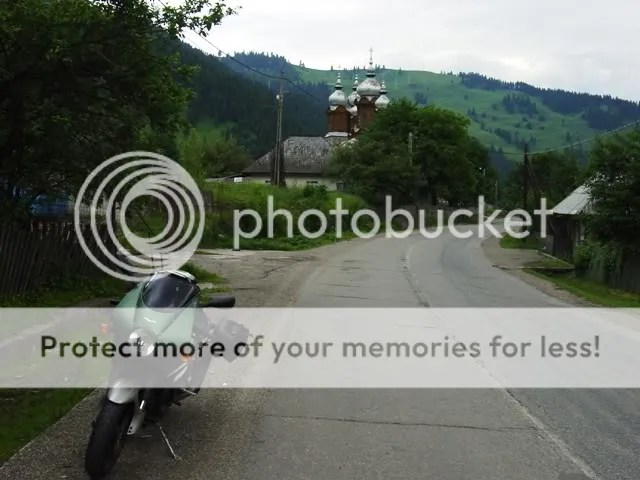
Entering Romania.

I’ve never been anywhere that had such beautifully crafted houses of worship, whether churches or mosques. For such a poor country, the amount of workmanship and labor that went into their churches was impressive.
Uhmm…I think I’ll keep moving on.

The terrain was beginning to have more hills. The Carpathians couldn’t be too far off. Approaching the city of Brasov, I saw my first glimpse of the Carpathian mountains. Not as impressive as the Alps or even the Pyrennes, but still impressive, nevertheless.

Romanian roads started out ok, and then steadily deteriorated. My last day in Romania I must have averaged 20 kph. Potholes just waiting to strike. Then it started to rain. Oh woe is me. A double whammy. Oncoming cars in your lane weren’t trying to run you off the road… they were just dodging and weaving around potholes. I was dreading a flat or a bent rim, but the mighty Guzzi escaped unscathed.

I could just imagine bending a rim then having to hole up someplace while waiting for a new one. Relaaaax…stay another night…it wont hurt a bite…errr…a BIT…it wont hurt a bit. Yeah… uh huh.
Actually, the hotels in Romania were easily on par with those in western Europe. I was pleasantly surprised. However, their coffee sucked. If there’s a special hell for coffee lovers, it must be something like Romania. I guess it depends on what you’re used to. Romanians may go to Italy and grimace when they drink Italian coffee. Their orange juice, on the other hand, was excellent… freshly squeezed.
The terrain was gorgeous, reminding me a lot of the Pacific Northwest. I’d say Romania is 40 to 50 years behind western Europe… probably on the same level as Latin America. Once they get their roads fixed it’ll be a great place to tour.
A Romanian lake.

I couldn’t follow the Carpathians into the Ukraine because of visa requirements, so I dodged back into Hungary, then made a quick lunge to the north into Slovakia to rejoin the Carpathians. The High Tatras are the highest peaks in the Carpathian range. This part of the Carpathians is a national park in Slovakia, as well as in neighboring Poland. Unfortunately, the weather still hadn’t improved much, so I didn’t have the opportunity to take any good pictures of the High Tatras.
I had one little incident with a Slovakian bus and a mud hole. There was a section of road that had been flooded by recent rains. Off to the side they had constructed a makeshift bypass. The bypass was also muddy from the rains. I had just about finished negotiating my way across the bypass when a bus appeared on the other side. Rather than waiting for me to exit, the “roads” scholar behind the wheel of this juggernaut decided to proceed. In doing so, he cut off my exit line, leaving me only a huge mud puddle to go through. I wasn’t about to risk seeing how deep that puddle was, so I came to a stop. As he came around me, his rear wheels started coming closer and closer. The sides of the bus started to rub against my left saddlebag.
I tried to hold the bike up, but I was no match for the bus. Over into the mud went the Guzzi. I managed to not join it in the mud. The bus driver is looking at me in his rearview mirrors as if to say, “wtf are you doing in the mud?” While I was looking at him as if to say, “wtf are you doing driving a bus?” I struggled to lift the Goose and finally managed to extricate it onto dry land. Nobody in the following cars came to my aid. I guess they didn’t want to join the fun in the mud. I was fearing a broken turn signal or a cracked fairing, but I was lucky. Nothing more than a liberal coating of mud. The bike now looked appropriately battle-tested.
In all my travels, Slovakia more closely resembled Northern California than any other place I’ve been to. The only thing is, the roads aren’t in quite as good shape. On the plus side, there is less traffic than California. Winding roads going through rugged mountains and following alpine streams make for great motorcycling.

The High Tatras.

From Slovakia I took a last minute detour into southwestern Poland just to say I’ve been to another country. I only travelled for about 100 miles in Poland, but it was nice hilly terrain, making for an enjoyable ride.
I entered the Czech Republic from Poland. I don’t know what it is, but my Canadian passport freaked out the border guards. They had to take it into the main office and confer with their colleagues. I guess they don’t get many Canadians. Fortunately, I haven’t had any troubles. After a few moments, the passport gets stamped and I’m on my way. Unfortunately, I haven’t been as successful in my money management. I have currencies from five different countries in my wallet. I never seem to spend it all before I’m into another country. It reminds me of the days before the Euro.
The Carpathian Mountains are but mere foothills by the time they reach the Czech Republic. They still make for some wonderful motorcycling roads, though. The Czech roads are the best I’ve encountered in the former Eastern Bloc countries. Fast sweeping roads through open hills then darting into dark forests with some occassional tight twisties thrown in… good stuff.

I met an elderly Czech gentleman at my bed & breakfast. He told me that he was 15 years old in 1945 when the Russians came and occupied his country. He fled with his family to West Germany where he lived in Cologne. When Communism fell, 40 years later, he returned to his old home town. He went to his old house and knocked on the door. The man who answered the door recognised him and gave him a hug saying, “this is still your house”. It was wonderful talking to this old man. I reminded me of the old John Prine song, “Hello In There”. I’m sure that same story was repeated all over Eastern Europe.
I made my way to Prague, which is similar to Budapest. Both cities straddle a river… both have enchanting architecture. Prague had a few more tourists, though. I took another rest day in Prague.

After a couple of days in Prague, I continued westward. I pulled up to the German border entry and received a doleful look. I said, “Hi. I’m Canadian.” The border guard said, “Bye. Go away.” Didn’t even ask to see my passport. I guess they’re not too worried about people on sport touring bikes. I laughed and went on my way. It surprised me a bit. I thought that would be the toughest border to cross.
I made my way across Germany to the southwestern town of Freiburg, near the Black Forest. A lot of great riding there. I got lost several times, but didn’t care as the roads were so good. It’s right next to the Swiss border, so it’s in the foothills of the Alps.

Picturesque German town.
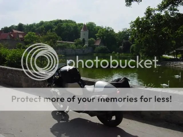
Right across the French border I noticed all these squiggly lines on the map, so I figured that’s the place I needed to be. Dang, those French not only know how to cook, but they sure do make some hellacious biking roads. The Germans aren’t too far behind.
Scenic village in the Alsace-Lorraine.

After working my way north thru Alsace-Lorraine, I re-entered Germany near Kaiserslautern. I must have hit the local biking road because there were bikes all over the place. Excellent roads through darkened forests.

From there I worked my way up the Rhine. Great weather on a Sunday… there were a bazillion bikes out. Great views of castles all the way up to Koblenz. There I hung a left and wandered down the Mosel River Valley, famous for its wines. Every tour of Europe should include a ride along the Rhine. There are roads on each side of the river. You can see the castles on the other side easier, but you can’t go wrong on either side.
Cochem on the Mosel

Everyone talks about the Alps, but there’s so much more to Europe than just the Alps. Don’t get me wrong, the Alps are spectacular, but don’t limit yourself to just one area.
I finally found a carwash. The Guzzi looked semi-respectable now. I was drinking a soda outside a convenience store…this woman gets out of her car…takes one look at me and my bike…thinks about it for a moment…then clicks on the burglar alarm on her key chain. I kinda liked that.
I followed the Mosel River into the tiny nation of Luxembourg. I ended up staying an extra day in Luxembourg. I usually blast through the tiny country on my way to something more interesting. This time I decided to spend a day touring within its borders. What a great choice! Wonderful roads along the Mosel River… other roads wandering through forests so thick that no sunlight penetrated the canopy in spite of it being a scorching day. I’ll defintely have to pay Luxembourg more mind in the future!
From Luxembourg I entered Belgium through the Ardennes, passing through many towns whose names recalled the Battle of the Bulge.
The Ardennes Forest, haunted by the ghosts of World War II.

From France to the English Channel the terrain devolves into rolling farmland. Not too interesting on a motorbike, so I got on the autoroute, blasted to the Channel, and hopped on the 5pm ferry to Dover, where I got a hotel room for the night. Met an old timer on a KTM 900 v-twin modified with a sidecar. He was on his way to an enduro event in Wales.
The White Cliffs of Dover.

The last day of my trip… and I wanted to make it count. I blasted west on the motorway all the way to Bristol near south Wales. This took up half a day, so I had another half day to enjoy as much of Wales as I could. At first it didn’t seem all that special, but the deeper I got into Wales the more I was captivated by its beauty and its GREAT motorcycling roads. I may have stopped to take more pictures on the last half day than at any other time on the trip. Maybe it was the realization that the trip was coming to an end and that stopping to take pictures might prolong it indefinitely.
Alas, I reached my friend’s house in Shropshire a little after 6pm, bringing the trip to an end. Here is a shot of the mighty, mighty Goose in the Welsh countryside on the last day of the trip.

I can’t say enough about my mount. As a city bike or an every day ride, yes, it may have shortcomings, but as a dedicated sport tourer it’s hard to beat. The sound of an Italian v-twin in song as it blasts through a series a curves is one of those things in life that makes the hair on the back of your neck stand up and make you glad to be alive. If you haven’t made plans to sell your current bike and purchase a Le Mans, please proceed to do so immediately.
Trip Summary:
May 31 to June 22.
7500 km / 4800 miles (it seemed like a lot longer with all the bad roads)
Rest days: 4
Traffic citations: 1, in Romania. I managed to negotiate it from 10 Euros up to 100 Euros. (I should explain. As the policeman was writing the ticket he asked how much my helmet cost. I said it cost 200 Euros. He said he makes 100 Euros a month. We continued talking. It turned out he was a biker himself and asked about getting a helmet from western Europe. I felt sorry for him after hearing what his monthly salary was, so I offered to send him one at no charge. He ripped up the ticket.)
Countries: 12. Italy, Austria, Hungary, Romania, Slovakia, Poland, Czech Republic, Germany, Luxembourg, Belgium, France, England, & Wales.
Bee stings: 0
Pucker moments: Many, many minor ones. 0 major.
Best T shirt seen: In Budapest, a picture of Che with a joint in his mouth with the caption: “fook the revolution”.
Best store name: In Romania I saw a shoe store named Al Bundy Shoes (they get a lot of American TV there).

2004 Portugal To Croatia
Starting out at my friend’s house near Porto, Portugal where my bike spent the winter months, I traversed southern Europe to reach the fortress city of Dubrovnik, Croatia. Whatta trip! 5600 miles / 9000 kilometers. 26 riding days, 3 rest days. I left Porto & headed east following the Duoro River. The road hugs the river & meanders through Portugal’s famous port wine growing region. It reminds me a lot of the road along the Mossel River in Germany. It definitely merits mentioning as one of the most scenic drives in Europe. I followed the river as far east as possible, almost to the Spanish border before turning south to check out the Sierra de Gredo. A smallish mountain range near Madrid.
Along the Duoro…

From the Sierra de Gredos, I turned north, towards los Picos De Europa. Across the Principality of Leon, the land turns flat & featureless. This terrain along the Duero was where the border between the Moors & the Christians stabilized for about 100 years. As such, the region is chock full of castles & fortresses as both sides sought to fortify their positions. After passing through the city of Leon, the terrain started getting interesting again as I approached los Picos De Europa. I enjoyed Los Picos so much, I ended up staying a couple days in Riano.
Approaching Riano

Another shot of the tasty asphalt in the Picos De Europa

Whereas last year, I enjoyed picture perfect weather, this year was spent under the threat of rain. While I probably actually rode in the rain less than 10% of the trip, the ominous presence of dark clouds cast it’s shadow over the first 2 weeks. Here is another shot of threatening skies in los Picos.


From Los Picos De Europa, I hugged the coastline along the Costa Verde towards the Pyrennes. I see what they mean by Costa Verde. I saw some spots greener than green. Every tree, shrub, bush & blade of grass was the exact same hue of green creating a “green out” effect. I crossed the Pyrennes at the Col du Somport. The weather was damp & foggy so…sorry, no pictures of the Pyrennes this time
I crossed the south of France using all the back roads. I saw one road on the map that followed a river so, it seemed like a good choice. It ran between Montauban & Rodez. I’ve mentioned before that I believe the French have some of the best motorcycling roads around. This road had some sweepers like I’ve never seen before. Lean right for 20 seconds, lean left for 20 seconds & on & on. It seemed surreal. I exited that section just shaking my head.
The French road engineers are true artisans. Here is another picture from the south of France. Mind blowing billiard table smooth constant radius 3rd & 4th gear sweepers. Just take this picture & multiply it by miles & miles. You get the idea.

Continuing to work my way across southern France was hard work!

Approaching the Maritime Alps on the French Italian border

When I got near Italy, I felt I had to choose between the Alps or Croatia. I sat at the fork in the road for about 20 minutes studying the map, pondering my options & arguing with myself I finally chose Croatia. Years ago, I had read an article in a car magazine that likened the coastal road in Croatia to California’s Highway 1. Seeing that Highway 1 is my all time favorite road, I was keen to sample the comparison. I blasted across northern Italy via the Autostrada in a bid to save some time but, after a half day of droning, I’d had enough. I veered north towards the Dolomites. In Merano, I took a well deserved day off to plan my attack of the Balkans.
I crossed over into Austria briefly before entering Slovenia via the Wurzenpass through the Julian Alps. Slovenia is a wonderful little country totally covered with mountains & with friendly people. The women seem to be an exquisite blend of German & Italian. The men…well, they looked like men to me 😀
The Wurzenpass.

The Julian Alps near the town of Bovec, Slovenia

I entered Croatia after a cursory passport check. No problems getting in. Croatia lies but 15 hours from Germany so, they are used to German bikers vacationing there. I had to make do with a cell phone advertisement for my “Welcome To Croatia” sign 😀

Making my way down the coast, the clouds seemed to be following me so, this clouded my perception of any comparisons with Highway 1. Here is a shot of the town of Rogoznica, totally covering a tiny peninsula. Lots of towns with strange sounding names like Zog seem to be places that might be ruled by Ming the Merciless.
Oh yah, the Goose sits in the foreground impatiently sitting through another photo session. Does this look like a bike that likes to sit around all day? No siree, Bob. She’s straining at the bit, raring to get going :naughty:

Right after this picture was taken, I suffered my biggest scare of the trip. A baseball sized rock materialized before me as I was waiting to pass a car. It glanced off my front tire & whacked my oil pan. I pulled over to check the damage. To my horror, the oil pan had a big chunk knocked out of it & it was dripping oil on the ground. I had remembered seeing an Aprilia sign a few miles back so, I turned around & headed back. The Aprilia shop couldn’t help me but, they knew a mechanic who could. I left the bike with him & took a hotel room. The next morning, he came & picked me up & took me back to the shop. He’d done a good job & patched the Tenni back up. Total lost time- 24 hours. Not bad. The roads in Croatia were pretty rough & uneven. My arm/shoulder sockets ached so bad by the time I got to Dubrovnik, I had trouble sleeping one night. All in all though, I’m glad I went.
I thought it would take about 5 days to reach Dubrovnik. It only took 2. Ooops…so much for good planning. Oh well, this provided me with more time to explore the coastal island chain.
Dubrovnik was shelled by the Serbians during the recent war but, the Croatians have done a great job repairing the damage. The place was full of vacationing Europeans. I saw buses from Poland, Hungary, Estonia and about a bazillion Germans. It seems the Croatia is the next south of Spain. The coastline is still wonderfully undeveloped. The Croatians are sitting on a gold mine. I just hope they plan well & don’t end up ruining it as they have the south of Spain.
The mighty mighty goose surveys the fortress city of Dubrovnik


An abandoned section of the old Adriatic coast highway just south of Dubrovnik

Heading back north, I began island hopping along the chain of coastal islands. The coastal islands are served by a whole fleet of ferrys making it easy to go from one island to the next. My favorite was the Island of Brac. A little gem of a rock full of sleepy little fishing villages. Oh…and great twisty roads made it seem like my own little Isle of Man…uhm until the local gendarme flashed his blue lights at me. oopsie
Here is a pic from Brac overlooking the little village of Povlja.

Overlooking another village on the Isle of Brac.

The fishing village of Milsa on Brac where I had a nice lunch of risotto dyed blue with octopus ink

Turquoise blue Adriatic off the southern end of the Isle of Cres

From Cres, I rejoined the mainland on the Istrian Peninsula, prized by the Romans for the quality of their olive oil. On the southern tip of the peninsula lies the town of Pula. The Roman amphitheatre at Pula is the sixth largest surviving Roman arena.

Heading north from Pula along the west side of the peninsula, I ran into tourist trap hell & the traffic that goes with it. I gave up on following the coast & headed inland. Much nicer. This is a fertile peninsula and was dotted with scenic farms.
I re-entered Slovenia, spent a couple days in the Julian Alps. I found that I still had 4 days left so, that left me a few days to play in the Italian Dolomites. I couldn’t believe how many bikes I saw in the Dolomites considering it was the middle of the week. The place was crawling with German & Austrian bikers.
On my second to last day, I spent rampaging through the passes around Cortina de Ampezzo. At around 4 P.M. I was passing through the town of Corvara when I felt a sudden shudder from the rear end. My first thought was that I had a rear flat. Upon dismounting, I found the tire to be fine. Hmmm. Seems the rampaging through all the passes had wasted my rear wheel bearing I made a call to my bike shop in Parma & we devised a plan. I would leave my bike at one of his friend’s house nearby then catch a train to Milan to catch my flight to Saudi. He would drive up later & pick it up. soooo, I wuz robbed of my last day of riding. I really can’t complain though. After a month on the road, I was well & truly spent. I was extremely fortunate the bearings gave out while I was going thru a town. It would have sucked to have broken down high up a mountain pass as the sun was going down.
This was my second rear wheel bearing failure. Both going out at about the 17,000 kilometer mark. Other than that, the Guzzi performed like an Abrahams M1 tank. Never missing a beat during the whole adventure.
Here’s a shot from the last day in the Dolomites.

